![]() Offline
Offline
Nope.
![]() Offline
Offline
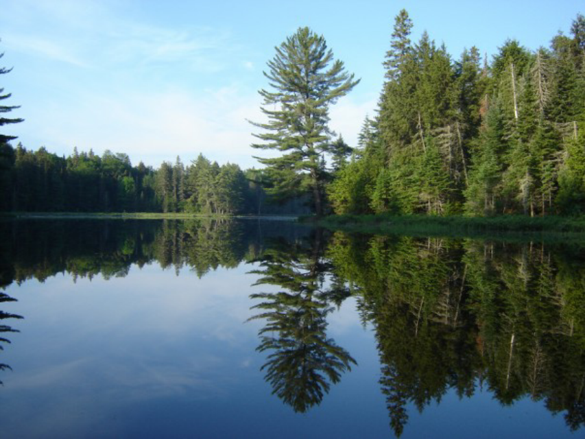
Canoe route. I was paddling when I took this picture, as would be probably everyone who's shared the same view.
But I would guess a relatively high proportion of those people would be day trippers, even though the location does lie on multi-day loops of various lengths.
Hopefully that's enough of a hint to get this one moving...
![]() Offline
Offline

I don't know where it's at but that's a great photo. You could flip that picture over and not know which end is up.
![]() Offline
Offline

Must be on one of the campground lakes. Pog?
![]() Offline
Offline
Thanks Russ, it was an early morning in June as I recall.
Not Mubwayaka or Pog.
![]() Offline
Offline
This is going unusually slow so I'll give a strong hint.
The picture was taken along one of the park's shortest routes between two access points. I'm not saying the very shortest, but one of the shortest.
![]() Offline
Offline
Not Smoke Creek though that would certainly fit with all the hints.
![]() Offline
Offline
Somewhere between Rock Lake access point and Galeairy?
![]() Offline
Offline

Madawaska River?
Last edited by MartinG (9/16/2015 1:08 pm)
![]() Offline
Offline
Not Rock, Galeairy or the Madawaska.
Looks like I've found a corner of the park that's hiding right under everyone's noses.
One more hint: travelling in the direction the camera is facing, the first car-accessible place you would hit would not actually be an access point.
![]() Offline
Offline
Canisbay or Cache
![]() Offline
Offline
I'm giving it to Shawn. It's basically the southeastern corner of Canisbay Lake, facing into the bay that leads to the portage to Cache.

 1
1