


![]() Offline
Offline

Website report:
The goal was to reach Roundbush Lake. Our plan was to follow the cart trail along the hydro line corridor as far as the portage to Vireo Lake, and reaching the lake to bushwhack along the west side of the lake as far as the portage to Creepy Lake. Arriving at Creepy we would have to bushwhack around the lake to the get on the portage that takes you over to Roundbush Lake. The following two maps, courtesy of Maps by Jeff, provide an outline of the intended route. 
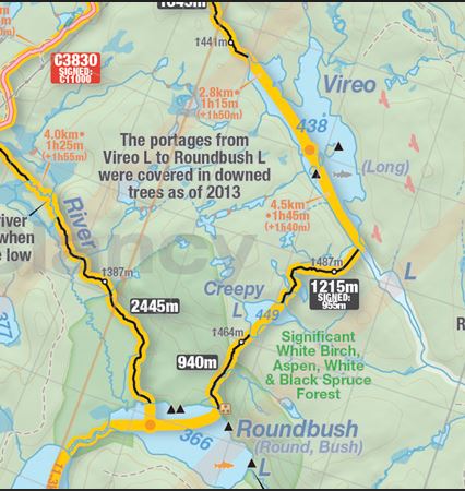
The first part of the trip involves a steady climb along the hydro line. Last year I received a note from someone asking if I thought it would be possible to travel the cart trail to McKaskill Lake by bike pulling a canoe cart. While it might be doable, it would be a real challenge pushing a bike and cart up these hills (see picture below). The trail begins at the Bonnechere River at an elevation around 261 meters but you have to climb to a point over 400 meters. On our way to Roundbush we would climb to 451 meters. This is the first of a series of hills you climb after leaving the Bonnechere River. At the bridge over the river there are signs indicating the road is closed to unauthorized vehicles.
 We chose to travel on the old, original road that dates back to the 1950s. This involves a steeper climb, but the trail follows a straighter line than the new road which twists and turns through the bush further to the west of the hydro line.
 Back on the new road and approaching the portage to Vireo Lake which starts at the foot of the hill ahead of us.
 This is what the portage looked like on Feb. 5, 2025
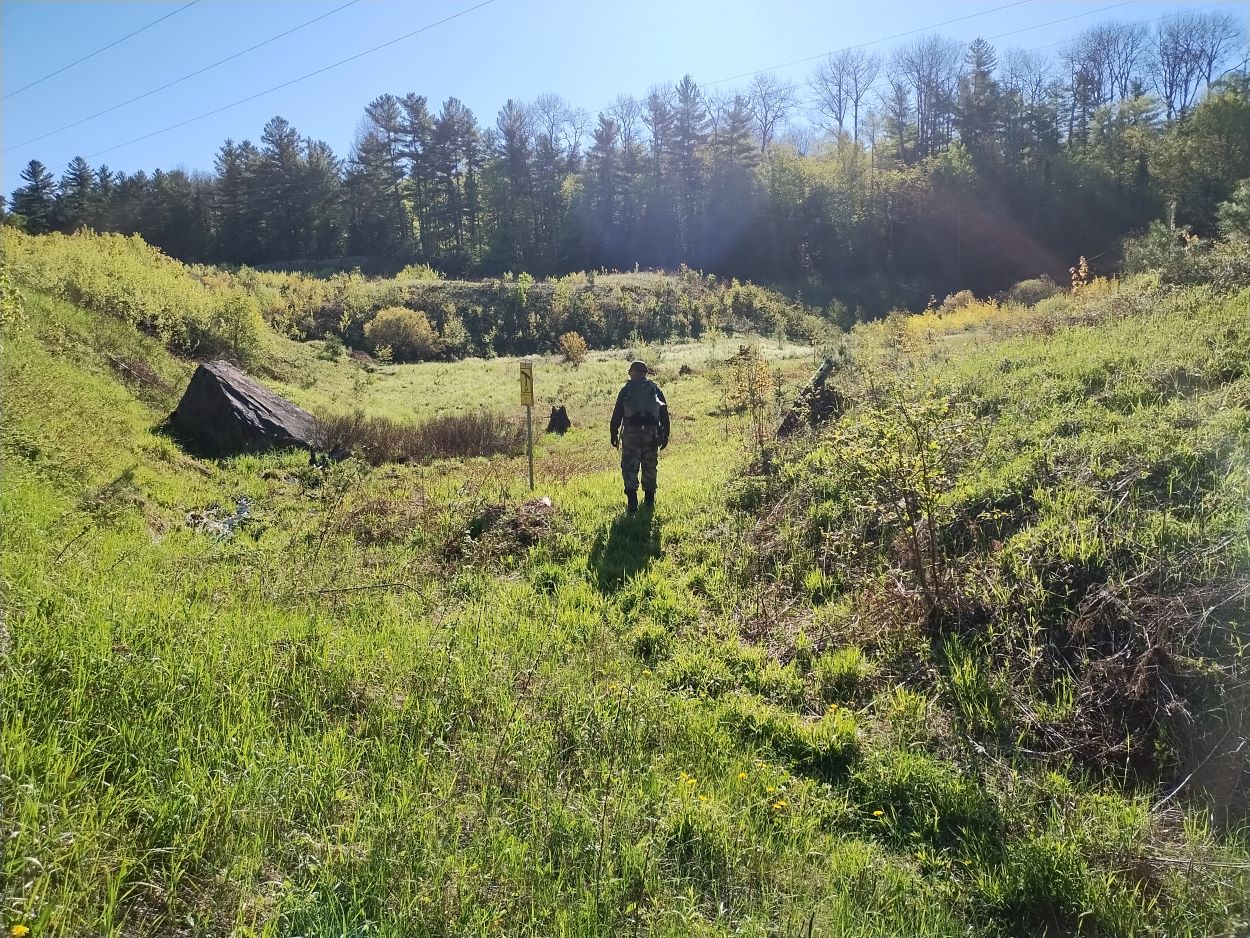 The portage on May 27, 2025.
 A post with a portage sign had fallen down over the winter so we got it standing upright again.
 The first stretch of the trail to Vireo passes along a stream, after which you enter more hilly terrain.
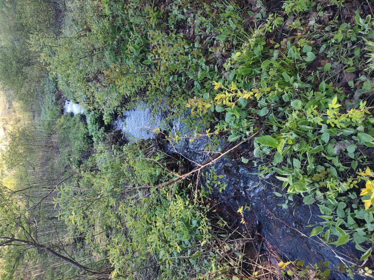 There were a number of small streams and wet, low lying areas to get across on the way in.
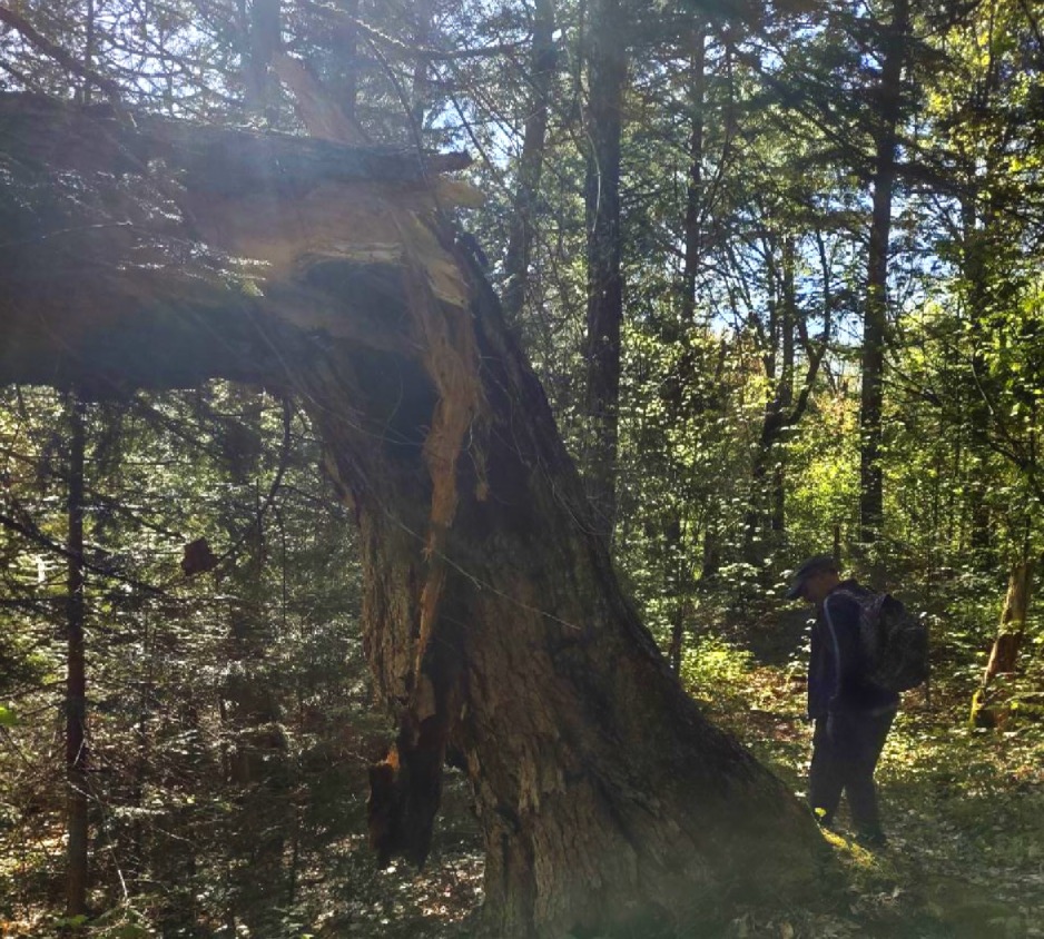
A once-mighty tree felled by the wind. Arrival at Vireo Lake
 At this point we started to bushwhack along the west side of the lake. By staying away from the shoreline some distance we hoped to avoid the deadfall that is a common occurrence along a lake. It would be a long bushwhack to reach the portage to Creepy -- just over 2 km.
However, after we had made our way down the lake a good distance we came upon a canoe lying in the bush that looked as though it had been abandoned. It was not secured, and was filled to the gunnels with water, sticks and debris. Clearly, it had not been used in a very long time. Patches on the hull suggested it had taken some hard hits. We got the water out of it and cleaned it up a bit, and decided to see if we might be able to use it to make our way down the lake. While it did take on water, we were able to bail as we went along. It was a lot nicer than bushwhacking. Both of us have been in canoes since we were young, but we stayed close to shore to be safe. We had to improvise to make some type of paddle. I always keep a roll of black electrical tape in my pack, so we each found a pole with a Y in it and filled in the Y with tape. It might not look like much but it served the purpose.
 It was one of those perfectly calm, warm mornings on the water that you dream about in the dead of winter.
 We reached the portage to Creepy.
 A better view of the put-in. There is a climb for a short distance after leaving Vireo but it's not difficult.
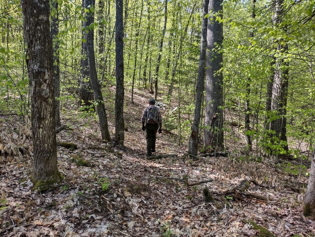 The trail between Vireo and Creepy. We were surprised to see what good shape the portages to Creepy and to Roundbush were in. It looked like they had been worked on last summer or fall.
 It was just under 1 km to reach Creepy.
To reach the portage to Roundbush we would have to make our way around the lake. In preparing for the hike we knew that going around the south side would be difficult because of a wide stream that flows between the lake and a pond to the east. The red line indicates our route. Image courtesy of FishOnLine As we made our way around the lake we startled a bear that was digging up the earth close to the shore in the top right corner of this photo. It immediately headed off when it heard us rounding this point. When we reached that corner of the lake we could see where it had torn up a rotting log in search of grubs and insects.
  An old beaver house along the shore. A hole had been dug into the den -- perhaps by a wolf. Wolves will dig into a den when scavenging, and will sometimes use an abandoned den for its own den.
 We made it to the portage to Roundbush, and nailed the marker back onto the tree.
 This area of the park is situated at a relatively high elevation. There is a 500m point just west of Creepy. After crossing the high point between the two lakes you start a long, steep drop down to Roundbush. For anyone portaging a canoe from Roundbush to Creepy this would be a difficult climb. I can understand why some consider this to be one of the most challenging portages in the Park.
 Roundbush Lake -- time for a break after more than 4 hours of steady walking and paddling.
 Two pictures of Roundbush
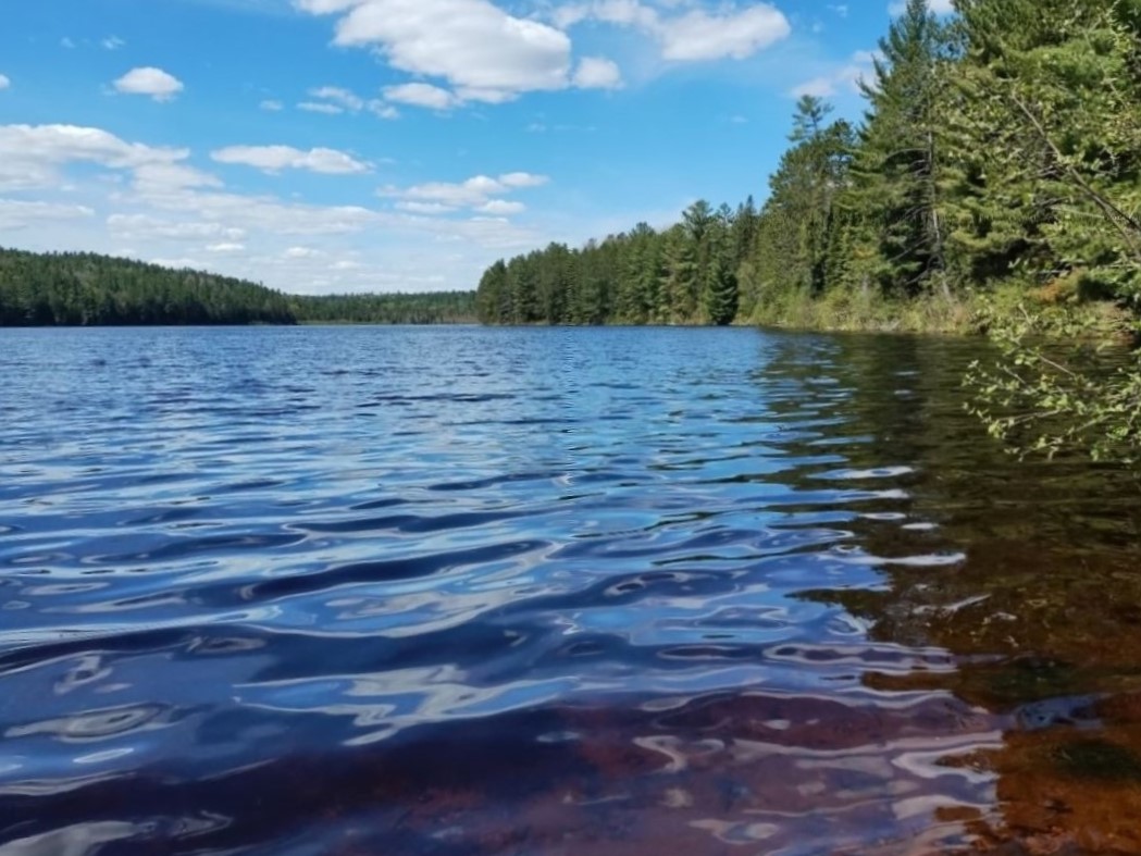
 After some lunch it was time to start the climb back up to Creepy.
 Coming down back onto Creepy Lk
On the hike back to Vireo we were concerned a strong wind might come up in the afternoon, making for a difficult paddle up the lake. However, there was little or no wind, and with our improvised paddles we made good time. We had to bail water often as we went. My brother being heavier than me in the stern got quite wet from the water that collected in the canoe. One of the two island campsites on Vireo. We didn't stop to check out the site. After passing the islands and making our way back to the spot where we found the canoe we left it there -- in better condition than we found it.
  When we had reached this location in the morning we left some water near the portage sign so that we would have something to drink for the last part of the trip. From here it was a 35 minute walk back to the hydro line, and then approx. 5 km down the road to the Bonnechere River.
Total distance travelled 23.75 km. Travel time was approx. 8.5 hrs. Average speed 2.97 km/hr.
Starting elevation was 262 meters; high point was 451 meters (620 feet difference).
Our route
Some of the plants observed along the route:
Red Belted Conk
Red Trillium
Downy Yellow Violet
Painted Trillium
Gay Wings, also called Bird-on-the-Wing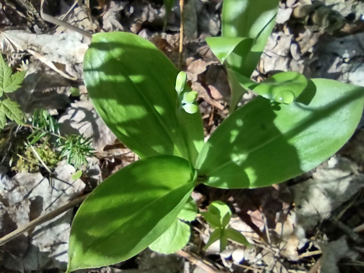
Bluebead Lily
Hobblebush
![]() Offline
Offline

Great trip!!!! Love the adventure. And a free canoe ahahahah. Hopefully someone else can use it in the future!
![]() Offline
Offline
Thanks for sharing! Really enjoyed the report!!!
![]() Offline
Offline

Great report!!! Thanks.
![]() Offline
Offline
Love this. Thanks for sharing your adventure.
The first part of the trip involves a steady climb along the hydro line. Last year I received a note from someone asking if I thought it would be possible to travel the cart trail to McKaskill Lake by bike pulling a canoe cart. While it might be doable, it would be a real challenge pushing a bike and cart up these hills (see picture below). The trail begins at the Bonnechere River at an elevation around 261 meters but you have to climb to a point over 400 meters. On our way to Roundbush we would climb to 451 meters.
Biking is doable but is it legal??
Last edited by Shayne74 (6/04/2025 9:11 am)
![]() Offline
Offline
Shayne74 wrote:
Biking is doable but is it legal??
I'd love to know the answer as well. From the photos it looks doable enough that I'd like to attempt it if I knew it was a permitted use. Same goes for the horsepacking trail into White Partridge.
![]() Offline
Offline

No it's not legal. Increasingly people are bikepacking the old rail lines and other roads through the park. Too bad the park has no vision for this. There's an awesome video of Steve Evans Bike Packing the 'Meanest Link'. Great video
![]() Offline
Offline
No it's not legal. Increasingly people are bikepacking the old rail lines and other roads through the park. Too bad the park has no vision for this. There's an awesome video of Steve Evans Bike Packing the 'Meanest Link'. Great video
I've thought this for a while now. The park is definitely not cashing in on this market. Ive seen a few videos of the rail bed rides as well as the measnest link. What a slogg that must have bean. I'd love to see more access opened up to wilderness backpacking.
![]() Offline
Offline

No it's not legal. Increasingly people are bikepacking the old rail lines and other roads through the park. Too bad the park has no vision for this. There's an awesome video of Steve Evans Bike Packing the 'Meanest Link'. Great video
I've thought this for a while now. The park is definitely not cashing in on this market. Ive seen a few videos of the rail bed rides as well as the measnest link. What a slogg that must have bean. I'd love to see more access opened up to wilderness backpacking.
The issue is logging right? If they open up more areas to bikepacking or backpacking, then your run more risk of people getting smoked by logging trucks, criticism of how carved out the Park is outside of the lakes, and lost income from forestry in areas that are newly packing areas.
I'm not saying I don't want to see more of the park and love the idea of a bikepacking loop being set up, but the economics and optics aren't there when there's so many other options in Ontario. Even within a 1hr drive of many park boundaries.
![]() Offline
Offline
Great write up and cool to see what are probably some less visited lakes in the park. I liked the flower photos at the end of the blog post, the Gay Wing flower is very interesting

 1 of 1