![]() Offline
Offline

At last falls gathering Jeffrey introduced us to a way to make a loop in the Panhandle. Sounded like a novel trip and a great adventure. Scott, Jeffrey and I did it in late April. The trip involved going from Hay Lake Access Point to Little Hay, where we spent our first night. Then we would paddle and portage to Scorch. One of the tougher routes in the park. Finally a Logging road and creek would take us to Drizzle Lake for our last night.
.
.
.
.
Paddling Hay Creek in the rain. It was cold, windy and rainy every day of the trip
.
.
.
Jeffrey and Scott paddling towards the lone campsite on Little Hay Lake. The campsite is OK. Enough room for 2 or 3 flatish tent spots. It has been hit by lightning a couple of times. That night we went to bed wet and cold and listened and watched as one of the worst lightning storms raged above us.
.
.
.
The next day was a long tough slog through little used ports, small lakes and twisty river to Scorch Lake. Despite being overcast it was a pretty good day. Scott sighed A LOT. I think I heard, "I'm too old for this crap!" more than once. But all in all we faired well.
.
Little Longer
.
.
.
Jeffrey showing us how it is done
.
.
.
Get out the way!
.
.
.
Beaver dam that blocks the York River between Little Longer and Little Branch
.
.
.
Handheld GPS units are so 90's. I got a new watch just for Jeff's V6 Map. Scott called me Dick all trip. Dick Tracy.
.
.
.
The building ruins on Little Branch are extensive. Probably generations of buildings going back at least a hundred years. There were two 40 x 40 Foundations for very old structures (Camboose Camps?). The remains of two other cabins and what could have been a cold cellar. There were many generations of garbage left behind by loggers and campers.
.
.
.
.
.
.
.
Marsh just before heading to Scorch
.
.
.
Entering Scorch
.
.
.
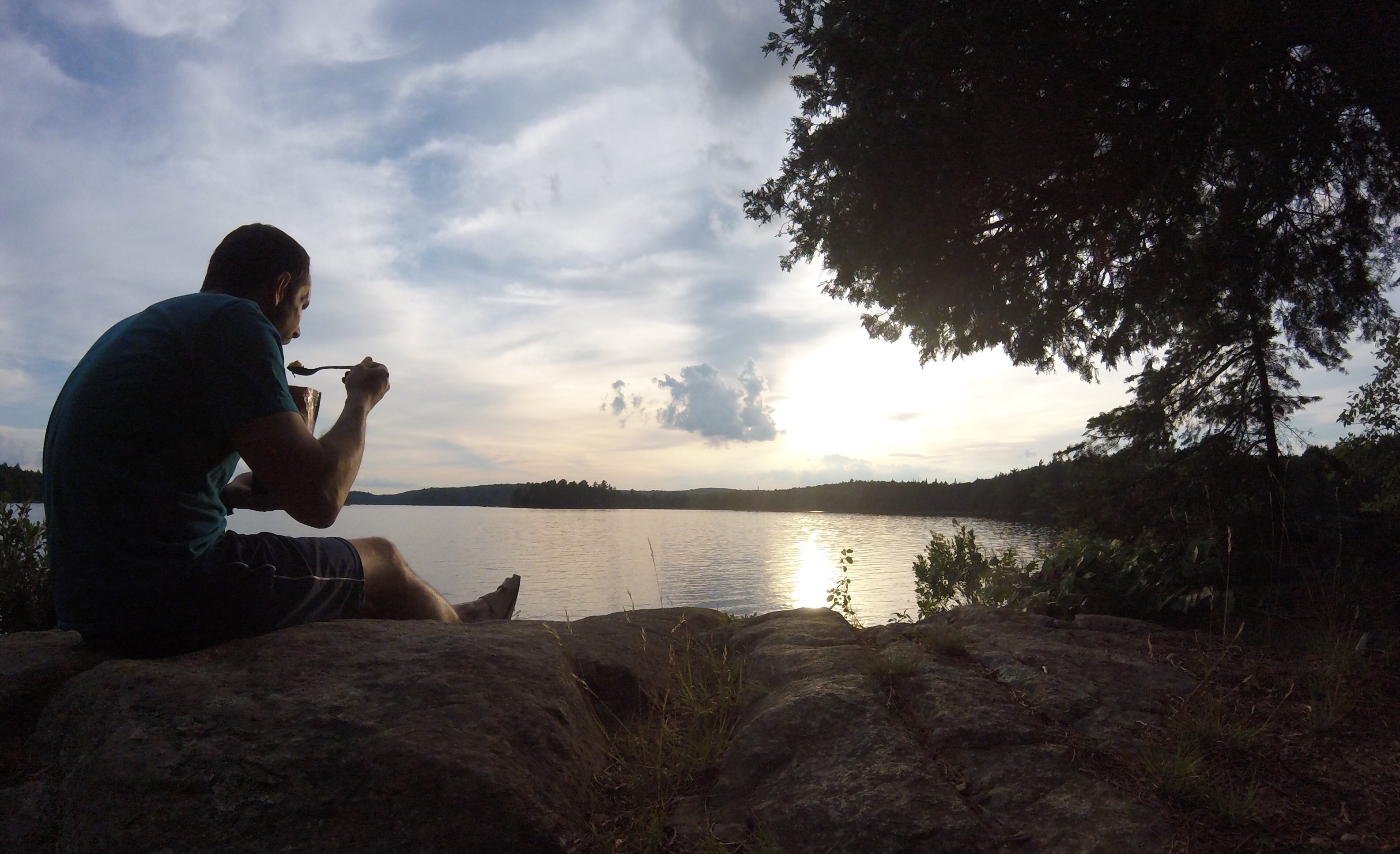
Scott making Dinner
.
.
.
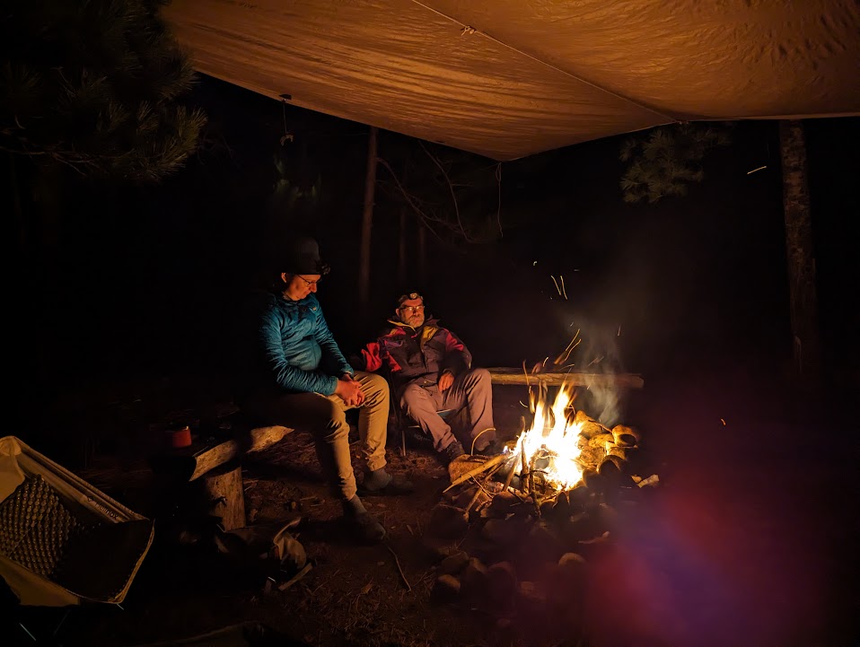
Enjoying a fire under the perfect tarp. I should teach a course.
.
.
.
Next day we decided to do a layover on Scorch. First up a trip to the lookout.
.
.
.
.
.
Second task of the day was to paddle the creek behind camp. We would take out where the creek hits a trail and hike our boats further on to a major logging road where they would be cached until the following day. We then hiked back to camp.
.
.
.
Along the way back we found the ruins of another old logging or maybe hunting camp. Old stoves, garbage dump etc.. Just before you get back to the campsite on Scorch there is another clearing for a hunting camp lease in the park.
.
.
.
.
.
It rained all night and all morning. Other than the rain, the day started off well with a simple but long march to Lostwater Lake. Conveniently, just as the road gets close to Lostwater there is an offshoot into the woods with a cleared campsite. We used this to access the lake.
Lostwater Lake (in the running for coolest lake name!)
.
.
.
Exiting Lostwater Lake is Otter Creek. At this point the creek is very nice!
.
.
.
We took a brief detour to Skunk Kitten Lake. (In the running for punkest lake name!)
.
.
.
More Otter Creek
.
.
.
.
Paddling the first 'section' of Otter Creek was very nice. Eventually it narrowed down. Progress was impeded by alder, logs and our first rapid. We forced our way through to a logging road and stopped to have lunch.
.
.
.
After lunch things took a turn for the worse. Then even worser. Finally worst ever.
First a bridge was out. That made for an interesting detour where I waded through waist deep water upstream of a rapid and water fall.
.
.
.
Then we hiked along side the creek for a couple of kilometers passing through this industrial wasteland. Eoin Sandison would be horrified.
.
.
.
Detouring east from the logging depot we crashed through the bush to get back to Otter Creek. We had chosen this spot because Satellite imagery had shown the worst of the Alder had been bypassed. Satellite imagery lied. The creek in front of us was choked with Alder. Not Upper Nip Alder, that's just mean. Not Maple Creek Alder, that's evil. This is Otter Creek Alder, pure hell. I think we put into the creek around 1 pm. It took us 2 1/2 hours to travel 1 1/2 kilometers. I don't really have pictures of it. I was in a pack boat with a double blade. You can imagine how much fun that was. Scott apparently took lots of pictures but lost his camera to one particularly hellish bend in the river.
.
.
.
.
.
Eventually we were stopped by a massive blowdown upstream of some rapids along the creek. We bailed to the 2nd ring of hell in the bush beside the creek. Having had enough of the creek we thought a nice walk in the woods was in order. Jeffrey plotted a course approximately 1.2km overland to an elbow in the creek about 500 metres upstream of Drizzle Lake. 2 1/2 hours of bush crashing, through various generations of logging thrash, wetlands and boulders we arrived back at the creek. It was 6:30 pm before we were finally able to get back into our boats and float down to Drizzle Lake.
.
.
.
.
.
Entering Drizzle lake through a culvert
.
.
.
It was Drizzling
.
.
.
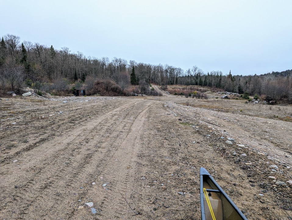
Drizzle is a very nice lake with almost no private land. An ideal spot for some fishing and camping. Unfortunately we couldn't find any campsites. Likewise we couldn't find any campsites in the southern end of Hay Lake. So, we ended our day paddling all the way back to our cars.
I'm getting too old for this crap!
![]() Offline
Offline
This is incredible. What a cool loop, great story and pictures. I love the watch. I see it’s a Garmin, what’s the specific model?
![]() Offline
Offline

Amazing. It looks miserable and fun in equal measure.
![]() Offline
Offline

Great looking trip!
I've got a Garmin Fenix 6 Pro Solar and got the maps in by just copying the GPS file straight into the watch. After messing around with Garmin Basecamp for way too long I was happy to see Jeff's work pop up in my wrist.
This basically makes navigation an absolute non-issue. Where am I? Just check my wrist and BOOM there you go.
![]() Offline
Offline
My watch is a Garmin Epix Gen 2. The full colour display is amazing. Brighter and cleaner in full sunlight than a phone screen or GPS screen
When you buy Maps by Jeff you get an email with instructions on how to download and install Garmin files onto a GPS. I just followed those instructions. I don't remember having any problems.
![]() Offline
Offline
Bampot wrote:
Thanks - I followed the instructions Jeff sent but they wouldn't load onto my watch. I was on the phone with Garmin for 2 hours and they said third-party maps are not supported and unfortunately, my watch needed to be reset which lost all my data. Hopefully I can restore a backup.
If you can't get Garmin BaseCamp to work, try connecting your watch to a PC as a mass storage device. Navigate to /FENIX/Internal Storage/GARMIN/CustomMaps. Copy and paste one of Jeff's Garmin Custom Map sections directly to the folder on the watch.
Make sure you are selecting one of the Garmin specific KMZ files. Not the ZIP, JPEG, GeoTiff or Google Earth KMZ files. Garmin has very detailed specifications for these files. Jeff's Garmin files meet these specs. Only do one section at first. Some devices only allow one map to be loaded at a time.
After it has copied over, eject your device from the PC. Once the map is on your device navigate to the part of the park your map covers and zoom in to 500 metres. Give it a few seconds for the maps to load over top of the default Garmin Topo Map.
Last edited by MartinG (5/02/2024 5:14 pm)
![]() Offline
Offline
I love how everyone looks grumpy, but Jeff looks like he's having the time of his life.
![]() Offline
Offline

Thank you for the most excellent report! What an amazing adventure. Awesome to see a trip report that goes off the "beaten path". Congratulations on a successfully completing a very creative, difficult loop.
![]() Offline
Offline
Excellent report and certainly a route for the "type 2 fun" memory banks. Virgin alder creeks are definitely hellish.
Funny how the garbage of yesteryear turns in the artifact of today. Sometimes it is still just garbage.
![]() Offline
Offline
I was thinking "hey that doesn't look too bad" right up until you got to the alders ...
![]() Offline
Offline
I love how everyone looks grumpy, but Jeff looks like he's having the time of his life.
LOL That's so true! Usually Jeff don't like the camera but this trip I think he was in his happy place.
![]() Offline
Offline

Nice trip report. I love hearing about trips that are off the beaten path. I also like that Scott and Jeff were riding in my favorite model of canoe. Maybe one day I'll own one.

 1 of 1