


![]() Offline
Offline

Chris Taylor has just submitted an example of a real "signed" campsite that doesn't appear on current maps ...
From personal experience, I can recall a campsite that was shown on many editions of official maps, as being at the very south end of Shirley Lake, I explored the entire south end of the lake both in-canoe and on-foot and was able to verify that no such campsite existed! From a campsite far to the north, I observed on more than one occasion, other canoe campers approach the location, explore about at length and eventually leave in apparent frustration.
And then there's a solitary campsite both shown on maps and existing in reality on Robin Lake (a very steep 485 meter portage east of Crotch Lake). However, there's no way one can reserve a campsite specifically on that lake!
Has anyone come across other examples of "unmapped", "missing" or "un-reservable" campsites?
![]() Offline
Offline

A Chickaree Lake campsite showed up in the official 1995 PDF canoe route map, but was gone by the 2009 version.
I'm unable to raise a Little St Anthony Lake on the 1995 PDF canoe route map. It has St Anthony Lake after a 705 meter portage from Brewer lake (north of Pinetree Lake and south of Hwy 60), but no campsite is shown for 1995 onward.
___________________________________________________________________
Back in 2010, the ABR conducted an exercise.
A spreadsheet of the results is still available here ...
With nearly a decade having passed since this exercise was undertaken, I'm wondering if new instances have cropped-up.
___________________________________________________________________
February 28, 2010 - Camping Values Inventory
There had been numerous concerns voiced by both ABR members and the public over numerous campsites having being closed over the years and what would be the net result to their total count.We developed an online utility which allows for the side-by-side comparison of various Algonquin Park maps. We specifically compared the 1995 and 2009 Canoe Route Maps. With the completion of this exercise, it became apparent that there hasn't been a net reduction in the number of backcountry campsites. Incidentally, the reduction of 17 campsites in the park's northwest corner has been roughly offset by the addition of 15 campsites in the park's south end. This process was remotely achieved by a number of members sharing the work online on sub-parts of the maps.
![]() Offline
Offline
Accessible from the Rock Lake access point, Whitefish Lake has three reservable sites and three sites are marked on the official CR map. There are, however, four campsite signs on the lake (as of July 2017, at least). The "extra" site is on the island at the north end of the lake. It is just south of PCI site # 3, around a point with lovely western exposure. There is enough separation from site 3 to make it viable as an additional site, plus there are tent sites, a firepit, a nice landing and a very obvious campsite sign. I didn't check to see if there was a privy.
Long story short, I discovered this because I reserved all three sites for two nights and on arrival, found the island site occupied. In the end it didn't matter that much because my projected group shrank in size and we only needed one site, and used # 2. When I asked the Rock Lake permit office staff about this extra site on the island, they denied its existence. I wrote an email regarding the extra site and the poaching of the site I had booked to the park manager in charge of this type of thing, and never received a response, even after a reminder email sent a few weeks later. Very strange.
![]() Offline
Offline

Opalescent has an extra site at the South end of the lake right next to the Southern-most site on the map. Neither the official map, nor Jeff's map show the site.
![]() Offline
Offline
@Gord, does this look right?
@UpTheCreek - Thanks, someone mentioned that one to me a little while ago and I was looking for verification that it did indeed exist, so thanks! Does this look correct?
@Barry - That site was added between 2014 (when the last version of my map was published) and now. It appears on the MNR's map.
![]() Offline
Offline

Regarding the Whitefish island sites. It's been a while since I was there. I seem to remember that there was only 1 official site on the island. There is a sign on the other 'site' that people may think is a campsite sign. I remember it as a no camping sign that was put up by the Algonquin First Nation.
I think the north site is the no camping site and the west one is the camping site. Or my memory is playing tricks on me.
![]() Offline
Offline

I knew I'd been to the Whitefish Lake campsite years ago, but couldn't find the related photos for days! Finally found them!
This first photo is approaching the island from the northwest. The height behind the canoe had a firepit of sorts and a 'no-camping' sign on one of the large pines.
The sand landing off to the right connects to a trail that curves back to the rocky height. The actual landing to the official campsite is located further to the south behind a treed point.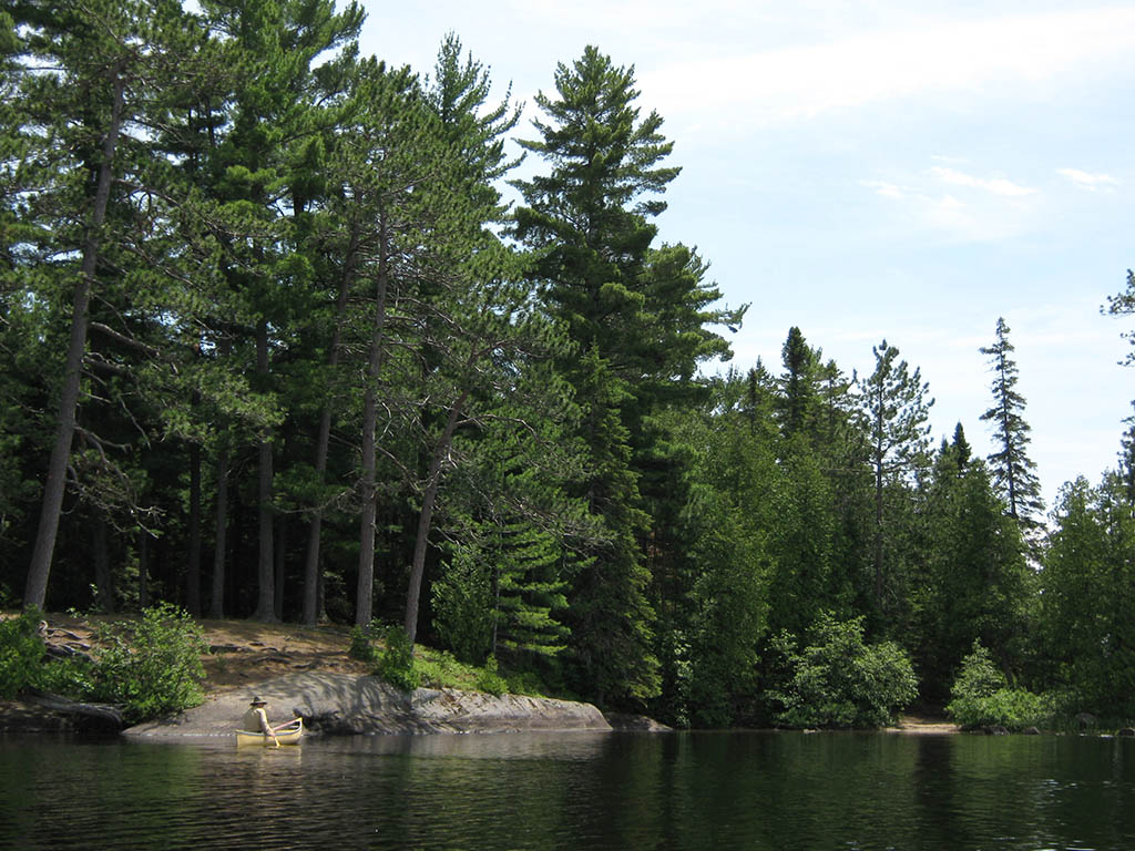
Looking back to the rocky height, you can just make out a "sign" (follow red arrow)..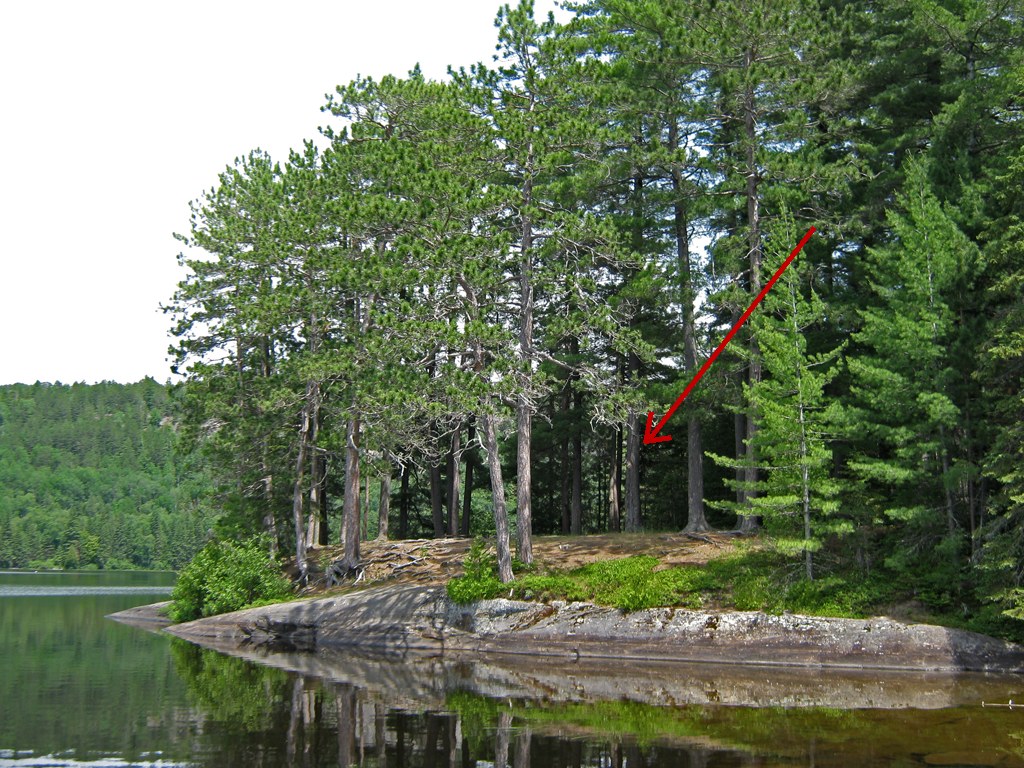
The sign was actually a "no camping" sign. Back in 2010 it was heavily impacted .. looked like target practice by thrown rocks.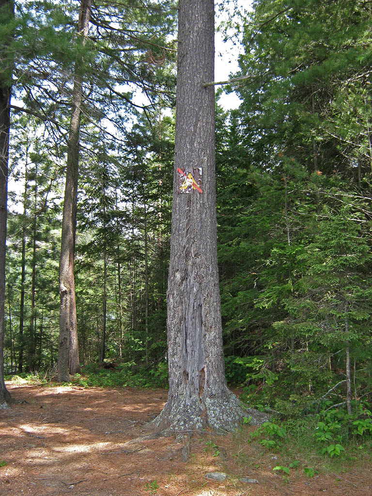
Following is a "blow-up" of the sign ....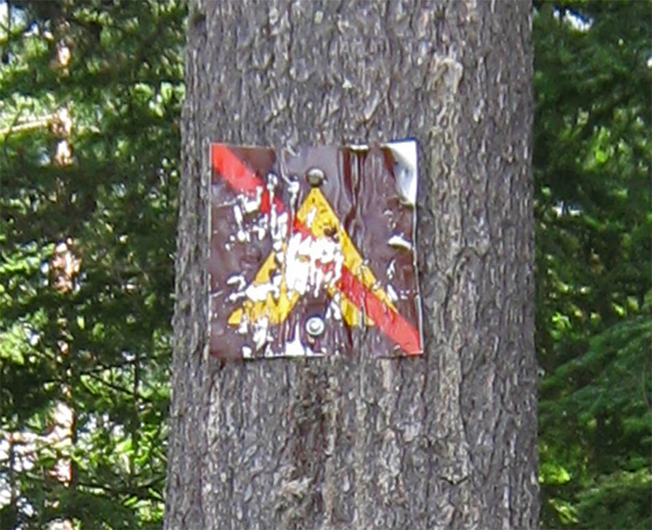
Below is an off-shore look at the official campsite, located on the south end of the island, beyond the previously mentioned treed point ...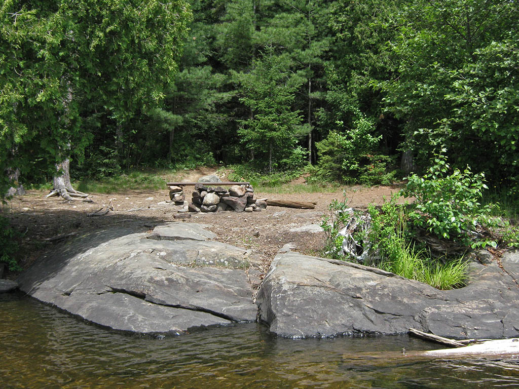
I imagine plenty of people camping at the official campsite use the rocky height as an evening sunset viewing location.
My apologies for not get ting the campsite into the PCI project way-back-when. The visit was on a daytrip- paddle from Mew Lake Campground in 2010. It's photos got misfiled and weren't entered into the PCI. Needless to say, I'll soon be making a belated entry of the campsite into the PCI project.
![]() Offline
Offline

Thought I'd search the island campsite situation further. I found myself on the old forum which has now been re-hosted by "Tapatalk.com" .
Norm Head made a posting, as did I myself!
I also posted a "copy-pasted" email from Andrew Chambers (MNR) who stated that there was only one campsite on the island (2012).
The old post is still accessible at ..
![]() Offline
Offline

jeffreym wrote:
@UpTheCreek - Thanks, someone mentioned that one to me a little while ago and I was looking for verification that it did indeed exist, so thanks! Does this look correct?
They're much closer together than that. Nearly right on top of each other. When we were staying there a few years back I think we were sharing the thunder box with the neighbors. I went back through my GPS data: I have it marked as N45° 52.500' W77° 39.435' from 2014.
![]() Offline
Offline
Awesome! Thanks Barry and Martin =)
@UpTheCreek - Woohoo, that's really handy =D
Would it be possible to get any other GPS data from you by chance?
![]() Offline
Offline

![]() Offline
Offline
I stayed at Whitefish Lake in Sept 2018. There are 2 campsites on the island & also 2 thunder boxes. Both campsites were marked. Could Whitefish lake have a 'spare' campsite for emergencies since there are only 3 sites available to reserve via the website.
Jeff: The Whitefish sites look right.
![]() Offline
Offline
Thanks Clarkey71! That's great to know ![]()
Re: A Spare Campsite - I can guarantee you that's not why that site doesn't appear on the map. There are a ton of lakes where the park leaves 1 or more sites free for that reason, but all of the sites appear on the map. This is presumably a recent change that isn't yet reflected on the map (or there was a breakdown in communication internally - also possible).
![]() Offline
Offline

I've sent an email to some contact email addresses I have on file. Hopefully we can get the official word back soon ...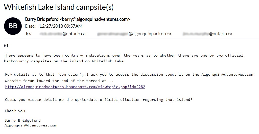
![]() Offline
Offline
On another note, I'll add the site on Guthrie to the misplaced site list. On both Jeff's Map and the park map it's shown on a small island, but when we went through in the spring it was actually at the site of the old ranger cabin. Although, I'll admit we didn't get over to the island to check out whether there's another site there as well, so it could be that that site is marked properly but there's a second on the lake that isn't. Either way, there's a site at the ranger cabin that isn't marked on any map. There's also a rusty bed spring bench there, if you feel like getting some tetanus while you sit beside the fire.
![]() Offline
Offline
Haha!
Yea, someone sent me photos of that a few months back so it's fixed on the new map ![]()
![]() Offline
Offline

Awesome!
jeffreym wrote:
Haha!
Yea, someone sent me photos of that a few months back so it's fixed on the new map