Ontario Interactive Fire Map

Skip to: New Posts  Last Post
Posted by Barbara
8/13/2016 10:52 am
#1

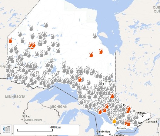
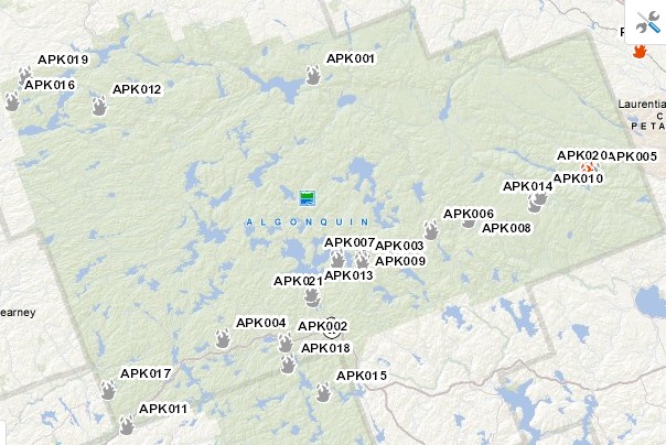
When you go to the interactive fire map, make sure to check "out", so you can see all the fires that have taken place in Algonquin Park (and the rest of the province) so far this year.  Below the map will be a text box, enumerating the fires and the causes.

http://www.giscoeapp.lrc.gov.on.ca/ForestFireInformationMap/Index.html?site=AFFES_ONLine&viewer=AFFES_ONLINE&locale=en-US


Barbara


Take everything as it comes; the wave passes, deal with the next one.

Tom Thomson, 1877-1917
 
Posted by Barbara
8/13/2016 10:58 am
#2

Last edited by Barbara (8/13/2016 10:59 am)


Take everything as it comes; the wave passes, deal with the next one.

Tom Thomson, 1877-1917
 
Posted by Barbara
8/13/2016 11:04 am
#3

Fires in Algonquin Park as of 13 August 2016:


Take everything as it comes; the wave passes, deal with the next one.

Tom Thomson, 1877-1917


Main page
Login
Desktop format