

![]() Offline
Offline
Hey everyone,
I'm planning on doing a two night, three day loop on the Western Uplands trail in July, likely the 7-9. I've been going to Algonquin for car and (mostly) backcountry camping for over a decade but I've never done any of this trail. I will be hammock camping for this trip.
I'm likely going to be going solo (which is fine) but I was curious to get other members opinions on the trail. Things like decent campsites to stay on at Maggie's Lake (West or east side) and things to check out/look for along the trail. My route is going to be the smallest loop. Day 1 to E.U. lake and Day 2 to either the west or east of Maggie's Lake, day 3 out.
Thanks everyone!
![]() Offline
Offline
Hi Chris,
There are no real lookout points per se on the 1st loop, but that doesn't mean there isn't lots to see and admire!
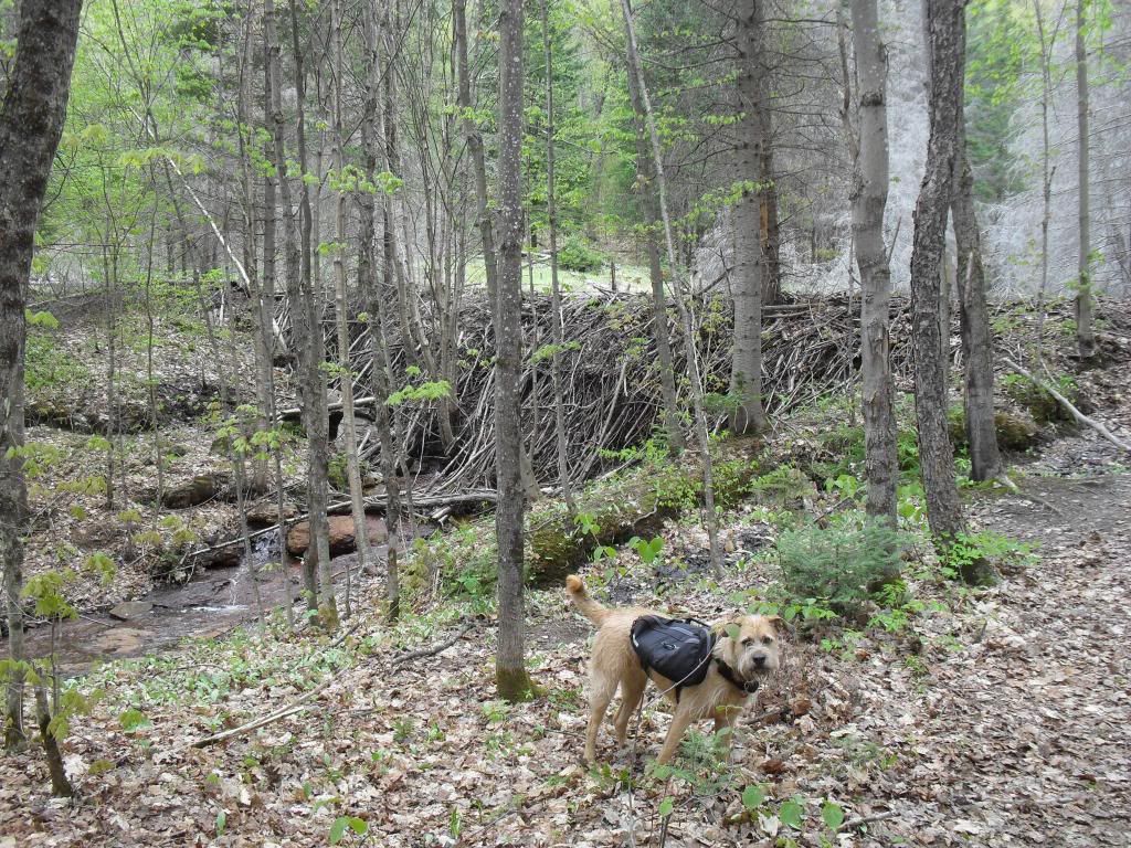
For Day 1, look for an impressive beaver dam to your right several hundred metres in from the trail head. Guskewau Lake is nice - the trail crosses a small stream running from the lake (Guskewau Creek?) and I find this to be a great spot to take a break, especially on a hot day. E.U. Lake is an awesome spot with a nicely placed campsite/firepit with wide views of the lake.
For Day 2, it will be mostly a bush walk. I'm not too familiar with the campsites on Maggie Lake as I tend to stick to the smaller/private lakes. I've stayed at Little Hardy Lake (2 kms south of Maggie) on a couple of occasions and it has what appears to be a nice sandy beach entrance for swimming, although I've never gone at a time of year when I could jump in. I'm pretty sure Maggie Lake has some really nice sites including great swim spots, so hopefully someone else can speak to that!
On Day 3, Little Hardy Creek is a nice area to take five and relax by the cool rocks and flowing water. Of course, Maple Leaf Lake is another spot where you can take a break and enjoy some final lake views before heading back out.
All the best in your planning!
Cheers,
Rich
![]() Offline
Offline
Hey Rich,
The information you have given me here is exactly what I was looking for. Lots of good info to take into consideration while planning on where to stay for night #2.
Thanks for your help!
Chris
![]() Offline
Offline
I may be wrong, but I think the impressive beaver dam Rich mentioned is on the way to Maggie from the trailhead, so if you're going to Guskewau, you won't see it until you're almost finished your hike.
Re: maggie lake. There is a nice point near the northeast end of Maggie south of where the east and west side trails converge. Jeff's map shows two sites there side by side. That site is huge and faces south.
I also found that some of the north side sites (going around the lake to the west side) were nice looking, though I never stayed there overnight.
I have stayed twice on the peninsula that juts up from the south side of Maggie. Merely Okay, and not worth going out of your way for. The best site there was burned and is now out of service for a while.
The sites nearest to where the trail comes in from the south (from Steephill lake) are heavily used. Not sure about swimming.
The trail around Maggie lake seemed to take much longer than I anticipated. But it's a beautiful lake and so much of the trail elsewhere is through the bush, that it was nice to see a lake while hiking. So it is worth it if you have the time and your legs are not too tired.
One of my favourite places in the park is north of Maggie lake. North side of Mink Creek. the south facing slope that takes you down to Mink Creek (in your direction of travel) has always been sunny, breezy, full of birdsong and bubbling water. Just one of those places that make you go aaaaaaah! it's good to be alive.
Agree with Rich that the cascading waters of hardy Creek are pretty nice.
Last edited by Methye (6/19/2016 1:25 pm)
![]() Offline
Offline
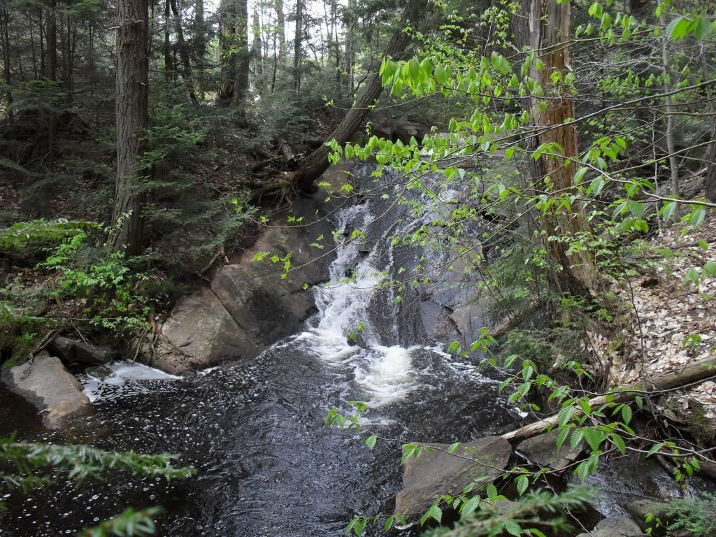
I checked some pics from my hikes and Methye is indeed correct about the beaver dam location - I'm not sure how I messed that up in my memory! There's another neat little spot between Maple Leaf Lake and the beaver dam where some water runs over a large smooth rock face, although I don't know how much water would be there during dry times...
![]() Offline
Offline
Methye wrote:
I may be wrong, but I think the impressive beaver dam Rich mentioned is on the way to Maggie from the trailhead, so if you're going to Guskewau, you won't see it until you're almost finished your hike.
Re: maggie lake. There is a nice point near the northeast end of Maggie south of where the east and west side trails converge. Jeff's map shows two sites there side by side. That site is huge and faces south.
I also found that some of the north side sites (going around the lake to the west side) were nice looking, though I never stayed there overnight.
I have stayed twice on the peninsula that juts up from the south side of Maggie. Merely Okay, and not worth going out of your way for. The best site there was burned and is now out of service for a while.
The sites nearest to where the trail comes in from the south (from Steephill lake) are heavily used. Not sure about swimming.
The trail around Maggie lake seemed to take much longer than I anticipated. But it's a beautiful lake and so much of the trail elsewhere is through the bush, that it was nice to see a lake while hiking. So it is worth it if you have the time and your legs are not too tired.
One of my favourite places in the park is north of Maggie lake. North side of Mink Creek. the south facing slope that takes you down to Mink Creek (in your direction of travel) has always been sunny, breezy, full of birdsong and bubbling water. Just one of those places that make you go aaaaaaah! it's good to be alive.
Agree with Rich that the cascading waters of hardy Creek are pretty nice.
Thanks Methye! A lot of great info. I think I'm going to do the trail around Maggie sounds good. I like hiking in the woods but I agree that it would be nice to see a lake for a change of scenery.
![]() Offline
Offline
Rich, no worries. It happens all the time with backcountry sites for me. Now I take a pic of the site and the next a pic from the site facing the body of water so I can make reference to it.
![]() Offline
Offline
hiker72 wrote:
I checked some pics from my hikes and Methye is indeed correct about the beaver dam location - I'm not sure how I messed that up in my memory!

Here's the Dam. It is indeed between the trailhead and Maple Leaf Lake. I remember when it was first built. Must be almost ten years ago, now. It's even more impressive in person. Never seen the beavers.
hiker72 wrote:
I There's another neat little spot between Maple Leaf Lake and the beaver dam where some water runs over a large smooth rock face, although I don't know how much water would be there during dry times...
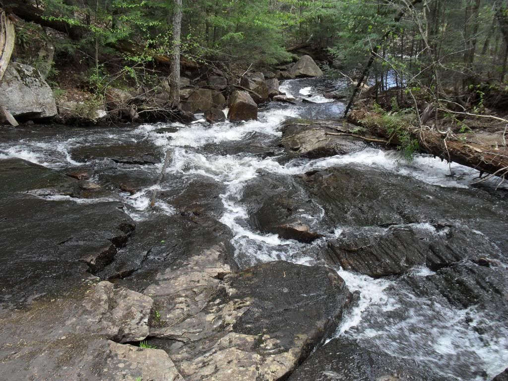
If it's the place I'm thinking of it is just before the little bridge by the bog/meadow. I have better shots on the old computer but here it is from both directions.

There is also some nice moving water after the little bridge as the trail goes to the right around toward the back of the bog/meadow. No pics :-(
As far as the trail goes, it's a nice workout. The general feeling is that it's a little easier going counter clockwise - a little more down than up through the more difficult mid-section. I've done it both ways and can't truly say I have noticed much of a difference. What I can tell you, though, is the leg from west of Ramona out is a lot more flat than what comes before and you may appreciate it more on the way out than going in.
We will look forward to your report.
Last edited by Algonquintripper (6/26/2016 11:37 am)
![]() Offline
Offline
Thanks for info and great pics Dave.
That beaver dam is massive!
I had planned on travelling counter-clockwise, lucky choice on my behalf.
Looking forward to doing this. When i have a bit more time and my sons are older I wouldn't mind taking them on the bigger loop.