


![]() Offline
Offline
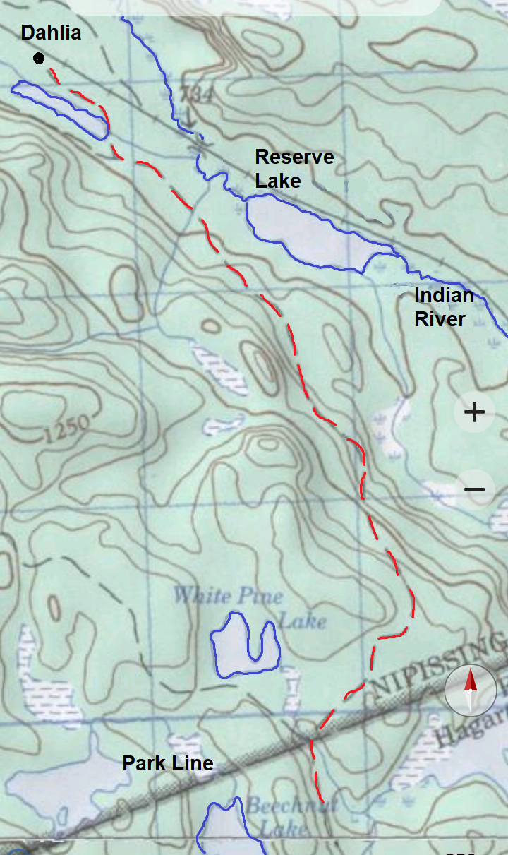
This hike took us to the far southeast corner of the park in the area around the Dahlia station on the old CN rail line. We hoped to check out three sites: the location of the former railway section buildings; the Dahlia ranger cabin; and a nearby building indicated on an older topographic map, and on Jeff's map, situated closer to the Indian River.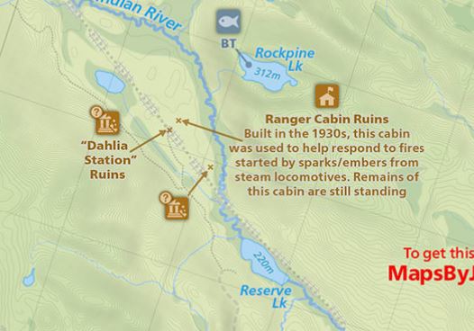
The three sites we hoped to explore. Map courtesy of Maps by Jeff.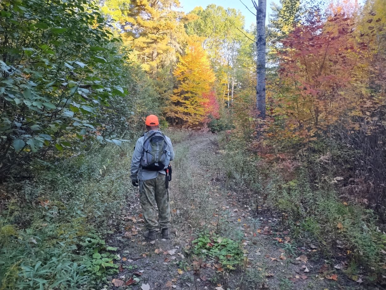
We started out at the park boundary on Beechnut Road. We both wore something orange for the start of the hike since the bow hunting season had started a few days earlier. Beechnut Road is popular with hunters throughout the bow and rifle season.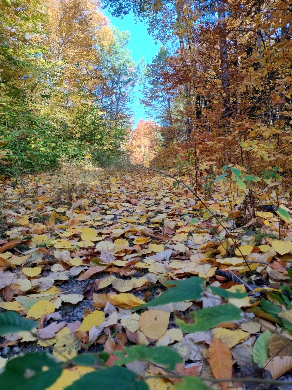
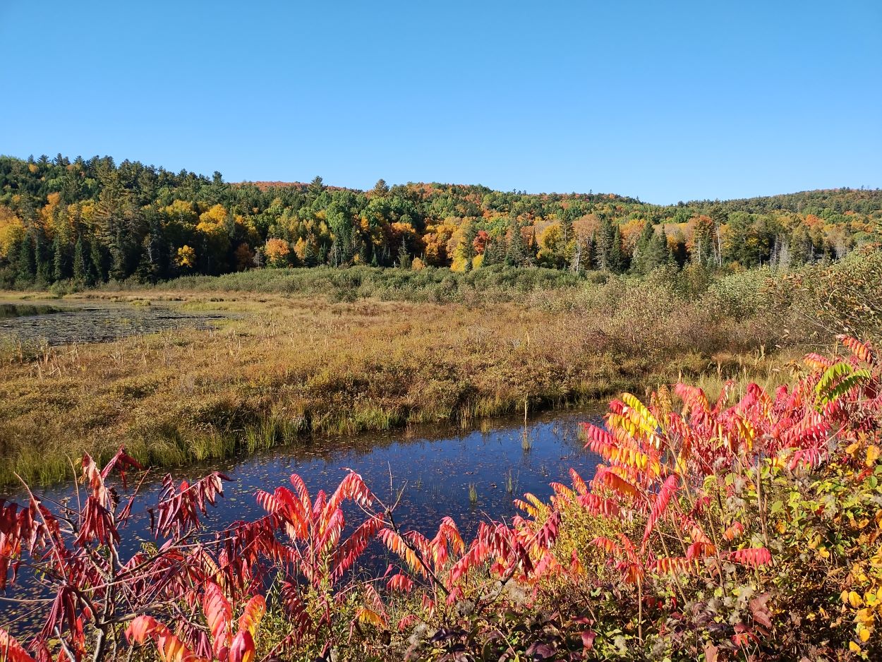
Colorful leaves floated down from the trees as we walked along.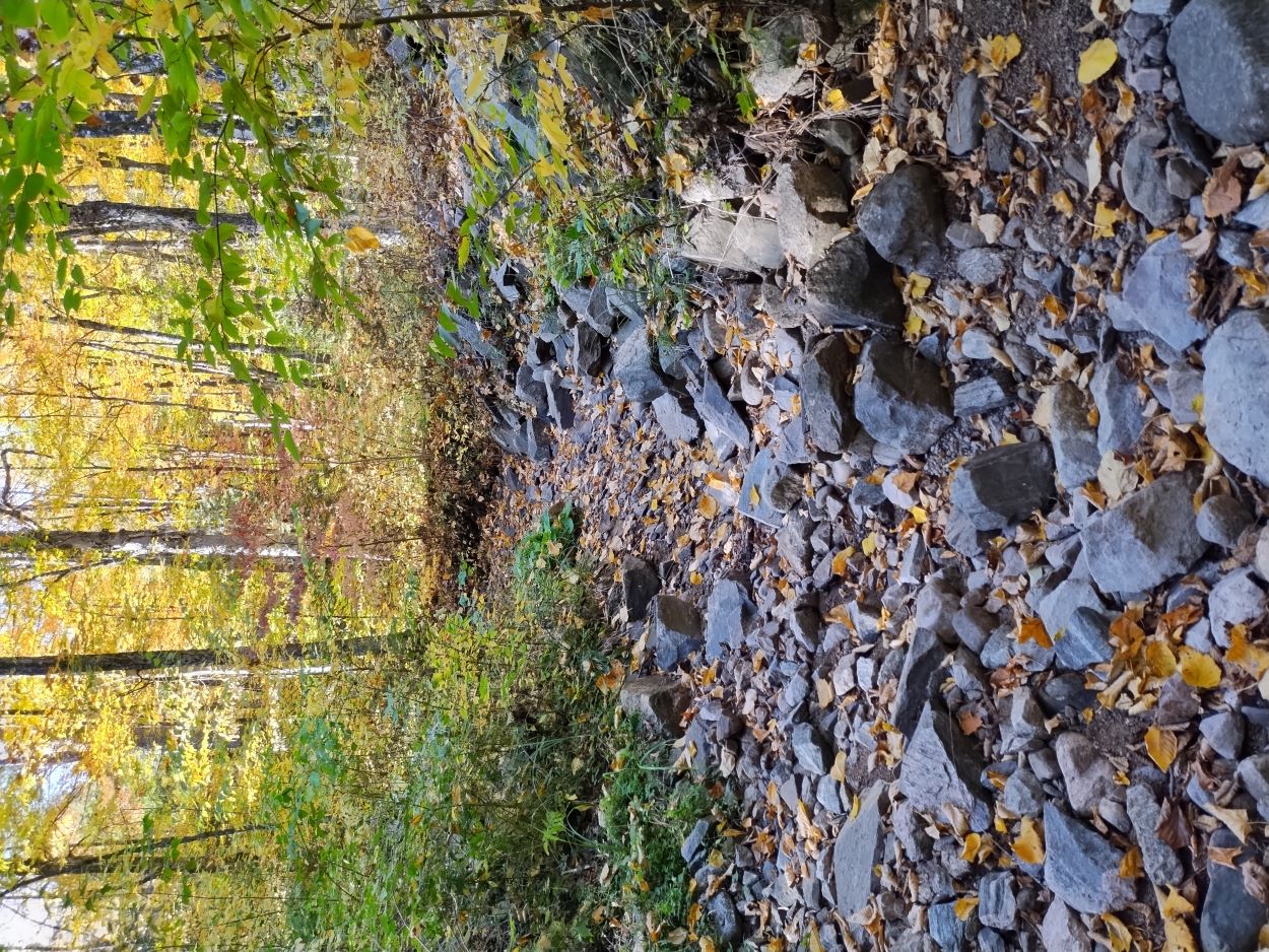
This dried up stream was an indicator of just how dry the summer and early fall had been. This stream flows into the Indian River just above Reserve Lake.
Algonquin Provincial (Ontario) Park, Canadian National Railways Map, 1926
The rail line through this territory began operating in 1915 as the Canadian North Railway. In 1923 it became part of the Canadian National Railway and was the main line from Montreal going west through Ottawa and North Bay before joining the Toronto main at Capreol. It was used by CN through the early 1990's until it was mostly abandoned in 1995 in favour of routing the remaining transcontinental by way of Toronto. Lifting of the tracks was completed in 1997.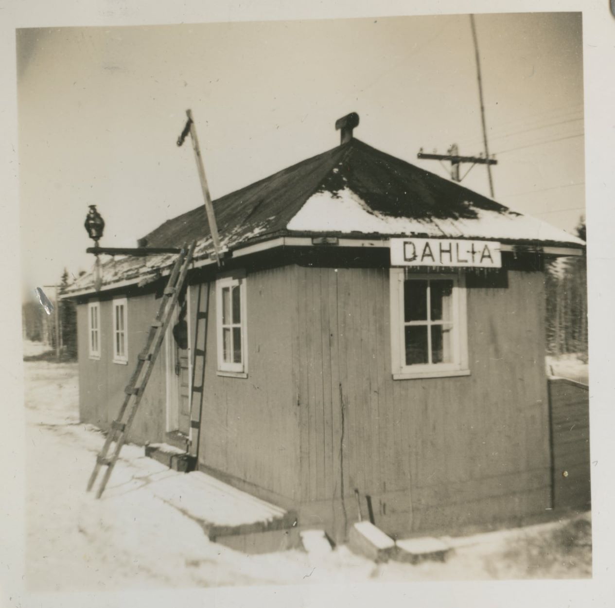
Dahlia section building in 1950s.
Photo Credit: Walter d'Entremont. Photo was likely taken between 1950-52. Photo courtesy of Pierre d'Entremont.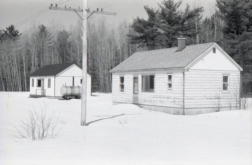
Dahlia section buildings, 1985.
Algonquin Provincial Park Archives & Collections, APM 6131. Used with permission.
Prior to the hike we talked with a man who worked along the rail line between Dahlia and Lake Traverse in the early 1970s. He told us that at that time there was a bush road from the Round Lake Road (Highway 58) right to Dahlia. He and his co-workers would take that road to Dahlia and then travel along the rail line on a speeder. 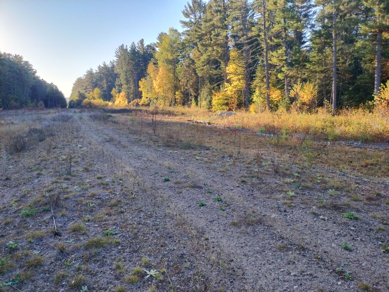
The railway section site today -- looking east.
This was our first time in this area. The site is quite wide. All the buildings have been removed. The train line remains the property of CN.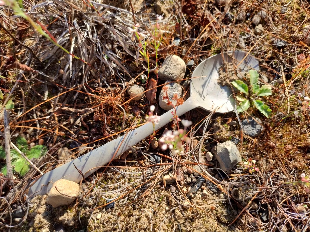
There are not many signs of rail history here. There are a few railway spikes on the railway bed. On the building site we came across this spoon. 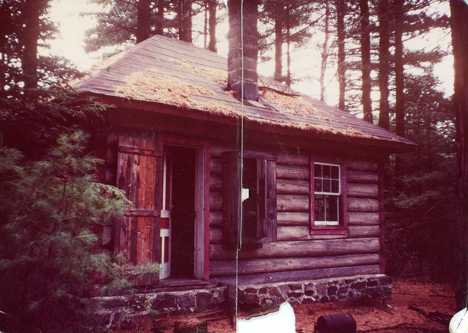
Dahlia ranger cabin, 1975.
Algonquin Provincial Park Archives & Collections, 2011.3.1. Used with permission.
The nearby ranger cabin had a stone and mortar foundation, and the entire building appears to have been painted red. Jeff's map notes that this cabin was built in the 1930s and was used to respond to fires that started along the rail line. Accidents and fires along the track were not uncommon as seen in the following article from the Ottawa Citizen dated Aug. 12, 1987.
Sixteen freight train cars derail in Algonquin bush
PEMBROKE - Sixteen cars from a CN freight train derailed in the dense bush of Algonquin Park Wednesday but no one was injured and there were no spills of hazardous products.
Canadian National Railway spokesman Jean Guy Brodur said the Ottawa-to-Winnipeg train went off the track on the Beachburg subdivision, about 50 kilometres west of Pembroke.
The derailment occurred at 2:45 p.m. between the whistle stops of Cathmore and Dahlia, about 16 km north west of the hamlet of Round Lake Centre.
The cause has yet to be determined although investigators from the Canadian Transportation Commission were on the scene.
The train left the tracks at the 13th car behind one of two locomotives, dumping a car loaded with automobiles, an empty gondola and 14 empty tank cars, Brodur said.
The empty tankers, previously loaded with sulphuric acid, did not leak, Brodur said.
A small bush fire possibly ignited by sparks from friction was extinguished soon after the crash. Crane and wreck crews from Capreol and Montreal were en route to the scene late afternoon Wednesday, Brodur said.
There was no immediate estimate of damage. The tracks were expected to be repaired by Friday. Until then, trains scheduled for Winnipeg will be re-routed through Toronto.
12/08/1987 Ottawa Citizen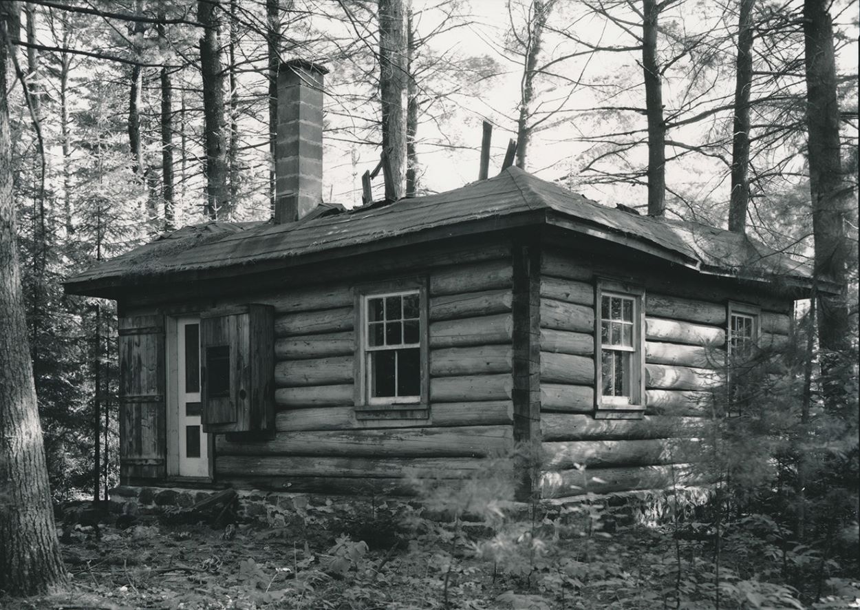
Dahlia ranger cabin, 1980s
Algonquin Provincial Park Archives & Collections,2004.24.20, S.R. Gage. Used with permission.
By the mid-1980s the roof of the cabin had started to fall in.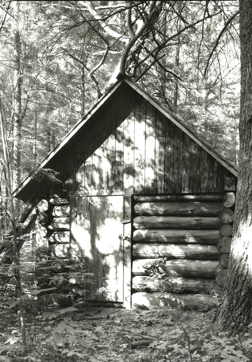
Dahlia cabin shed, August 1984
Algonquin Provincial Park Archives & Collections,2007.10.21, S.R. Gage. Used with permission.
Images of the cabin and shed taken in 2019 by Ash Phipps are available on the following site: By Paddle or Trail - September 2019.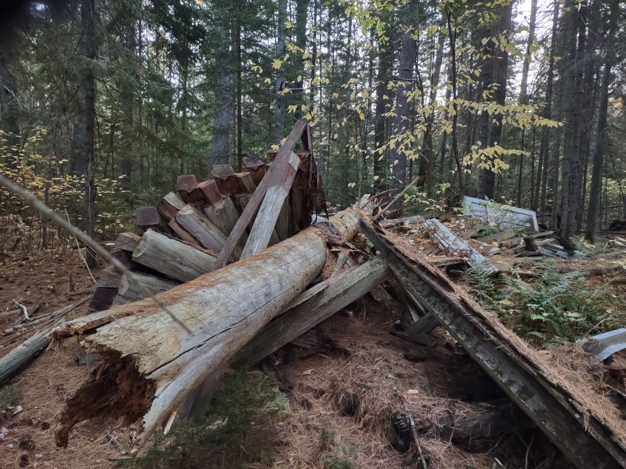
The cabin today - Oct. 2025. It is not visible from the rail line clearing. A tree has fallen on the building flattening the structure.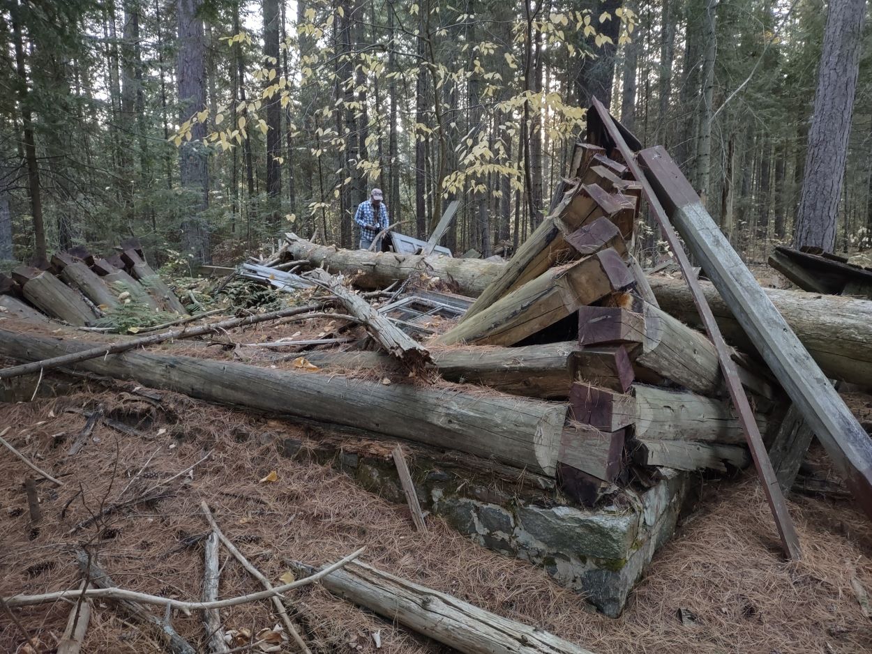
The stone foundation is still visible.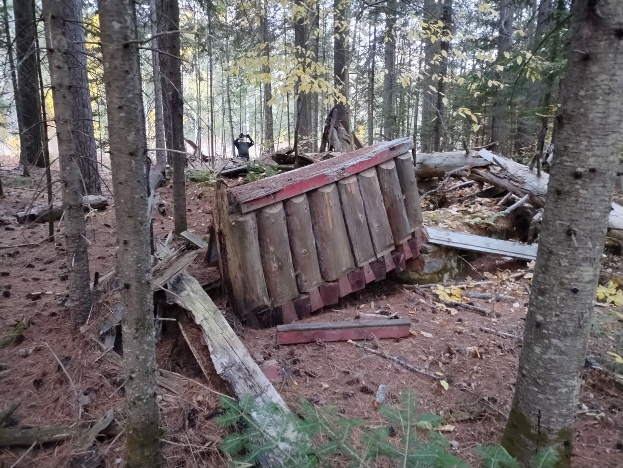
This log section was adjacent to one of the windows of the building.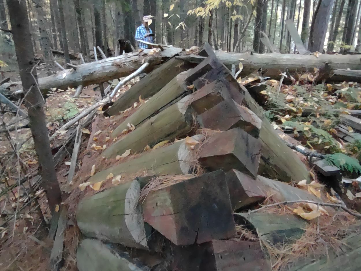
Dovetail notching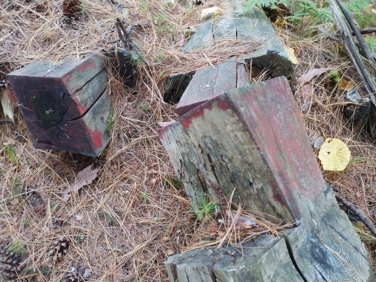
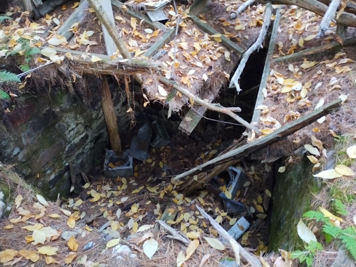
We were surprised to see the cabin had a deep cellar lined with stone walls. A wood stove and parts of the the chimney structure have fallen into the hole.
The nearby log building which was referred to as a shed in the 1984 photos appears to have been an older building than the ranger cabin. Here a saddle notch was used on the logs. 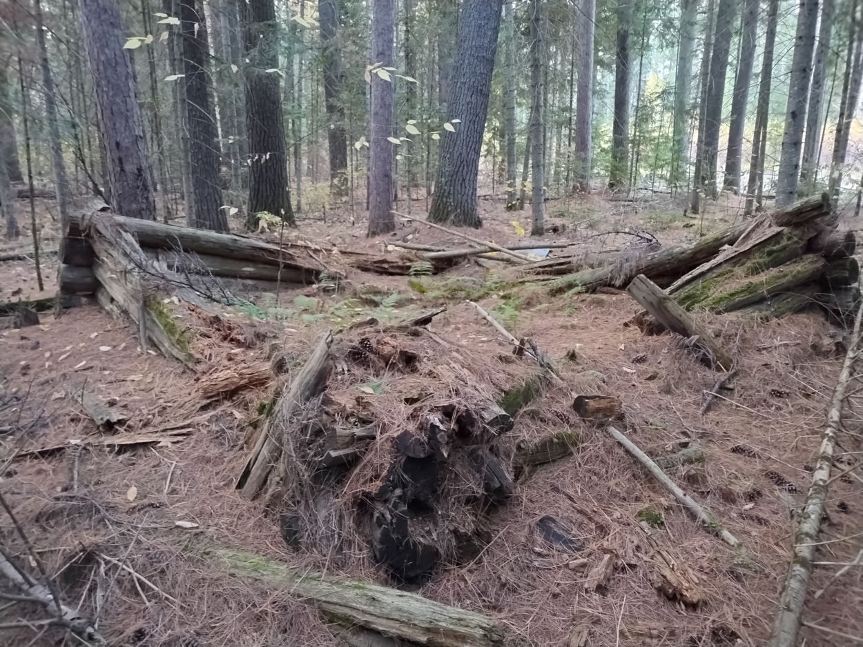
After spending some time at the ranger cabin site we hiked further east to look for the building that was noted on a topographic map dated 1943 (see below). It would take some searching since we had nothing but this dot an a map to go by, and we didn't know whether there would be ruins or not. 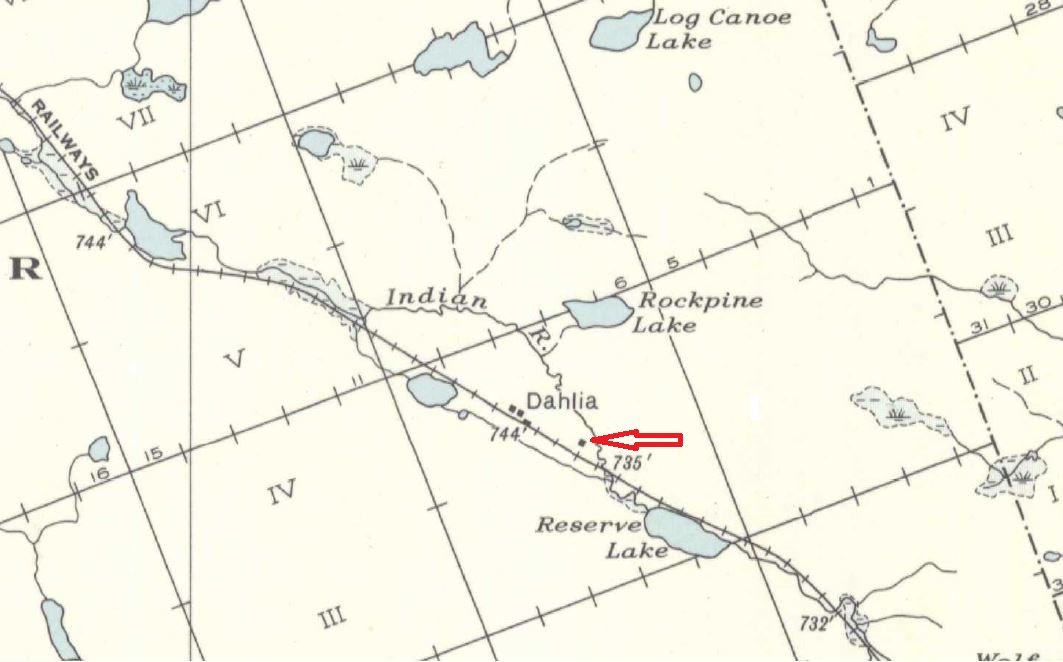
Department of Mines and Resources, Cartier Lake, Map 780A, 1943
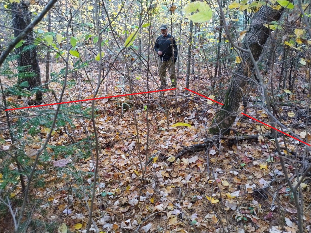
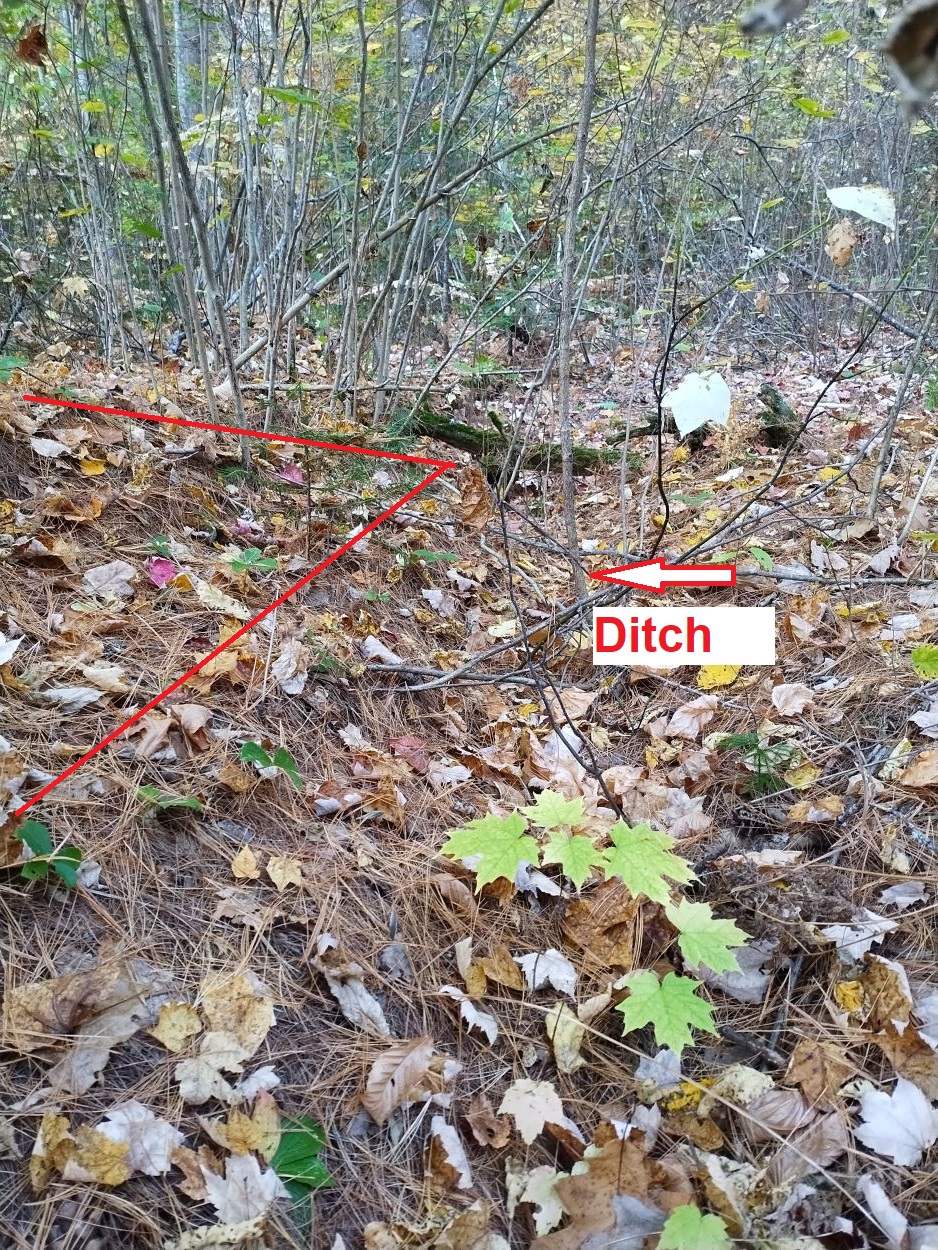
We spread out in order to cover more territory, and it wasn't long before we came to what was clearly a man-made trench or ditch. Following that line we came to a mounded perimeter with another ditch around it. That rectangular ditch joined the parallel ditch we had first come across. It directed water down toward a marsh through which the Indian River flows.
The thick layer of leaves on the ground made taking photos difficult, but the rectangular mound, which we have learned is often an indication of a foundation of a log building, is clearly visible when you are on site. Below are a number of photographs in which I have highlighted the mounds and trenches. We also found a number of artifacts not far from the foundation site. If this was a log building the logs have long since rotted away.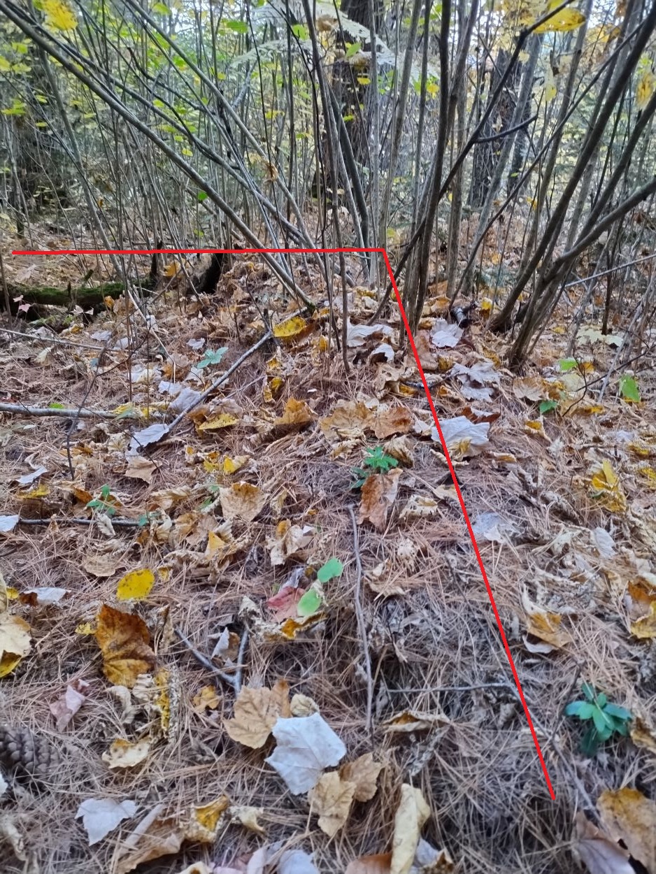
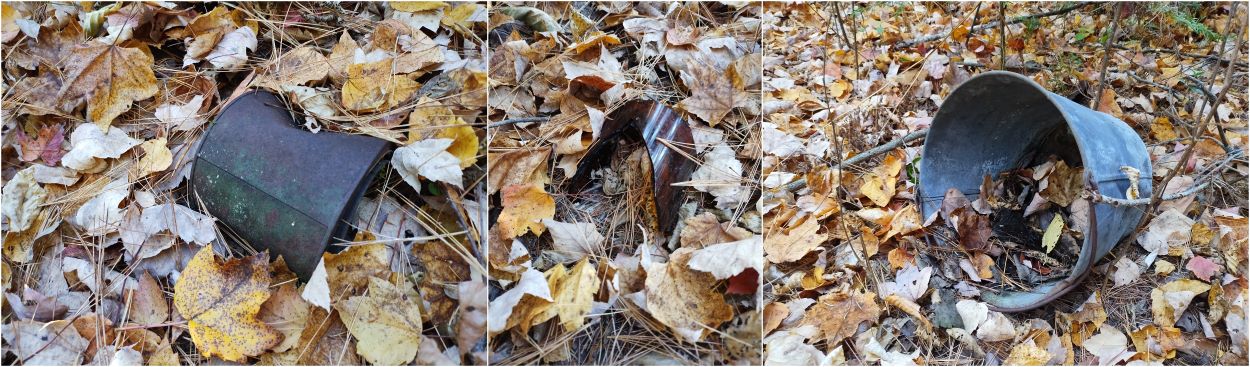
Found not far from the mounded foundation -- tin can, thick glass bottle, galvanized pail.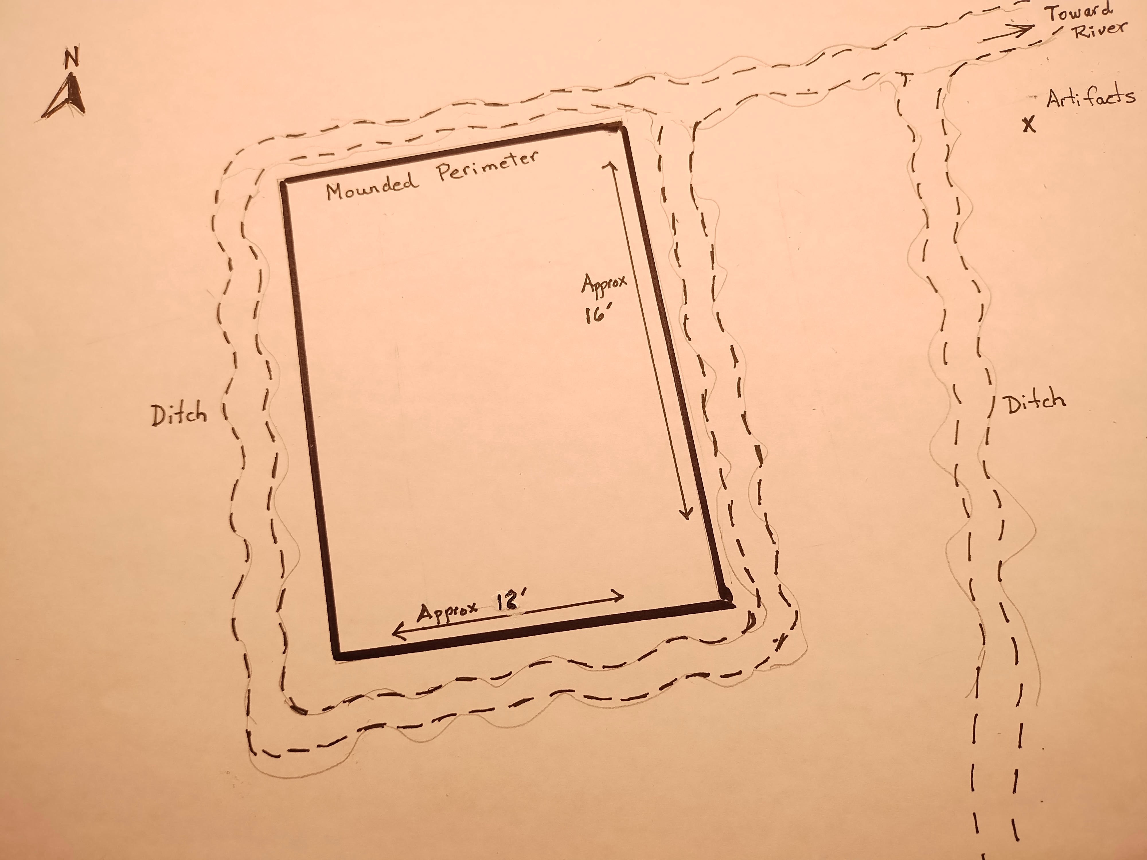
A rough sketch of the site. The interior space would have measured approx. 12 feet by 16 feet. Perhaps it was a building used during early logging in the area, or perhaps a trapper's cabin? Whatever it was used for, the builders went to a lot of work to dig an extensive ditch system to drain water away.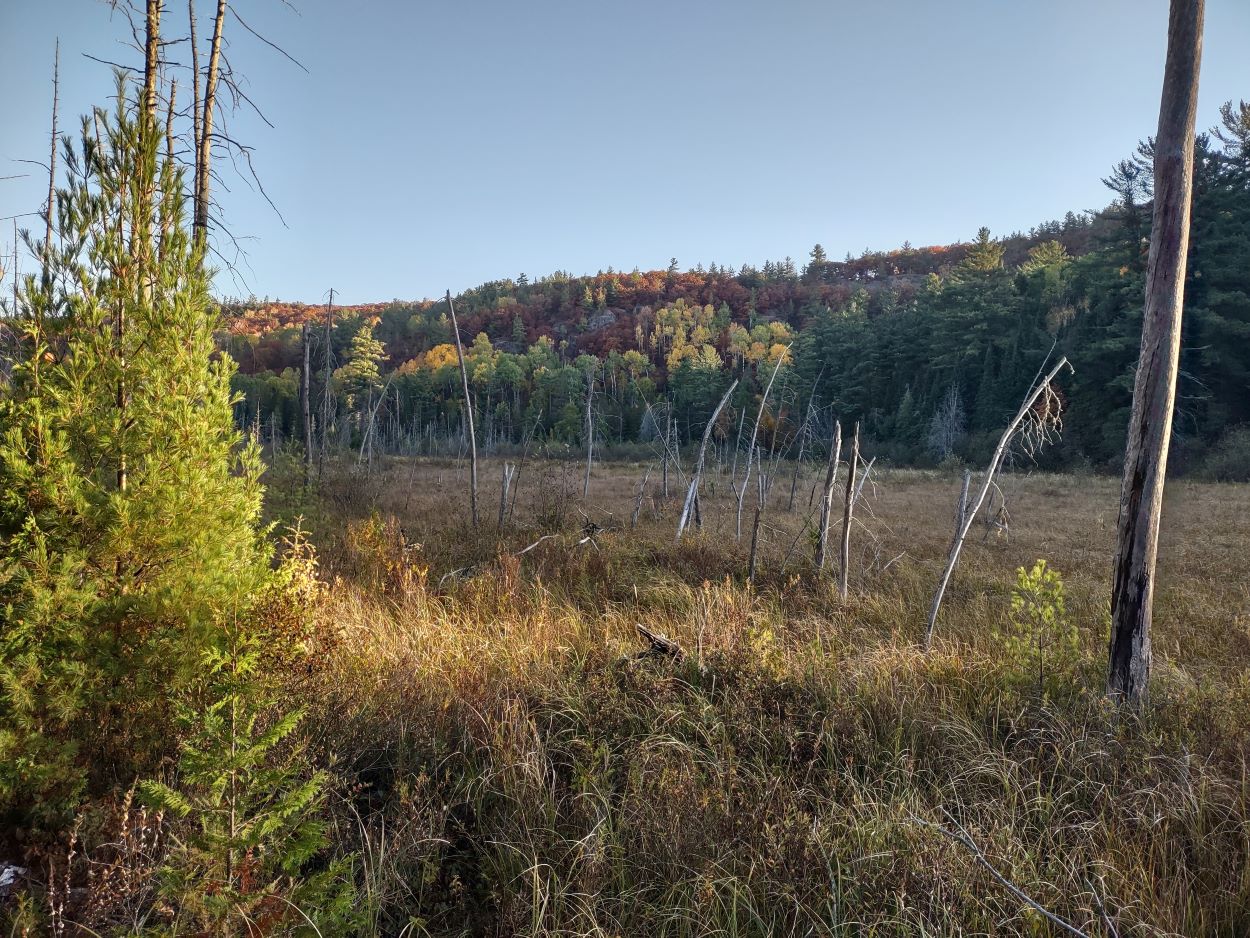
The building was situated on a section of higher, level ground just above this marsh. The Indian River flows through the middle of the marsh.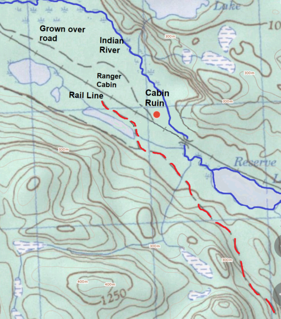
Having found the site, we noticed it was situated alongside what was once a road or trail. This map, which we were using to track our hike, shows the building was very close to the road (grey broken line on the map). The red line shows our route in.
The outline of the road is just barely visible today but it can be discerned by the smaller trees along the route, which stand out as being different from the surrounding forest. The map shows the road running west, away from the railway line. and then back parallel to the track.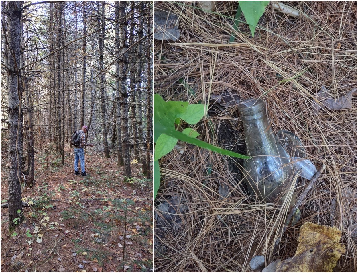
We followed the faint outline of the road for a short distance. The bottle lay partially buried on the road surface.
The next series of photos shows the Indian River above Reserve Lake. I've noticed there aren't many images of the river available online so I thought this might be of interest to those who have ever considered a canoe trip down the river.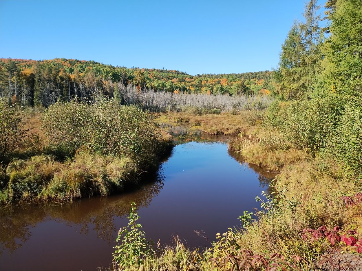
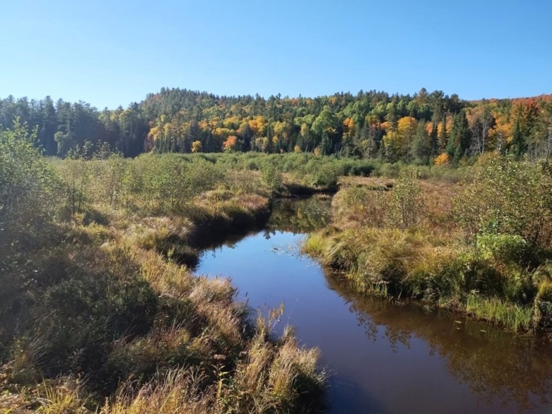
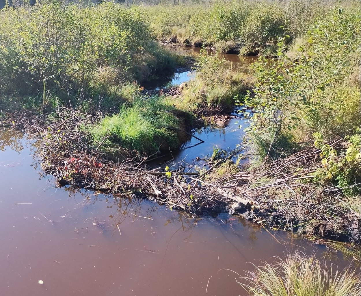
I wouldn't want to give the impression that it would be clear sailing all along the river. In the short distance of the river that we walked along we saw beaver dams, such as the one above, and sections that were clogged with alders.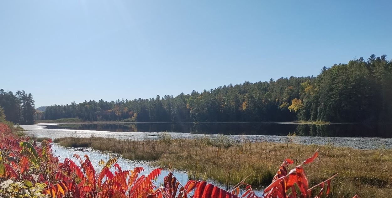
Reserve Lake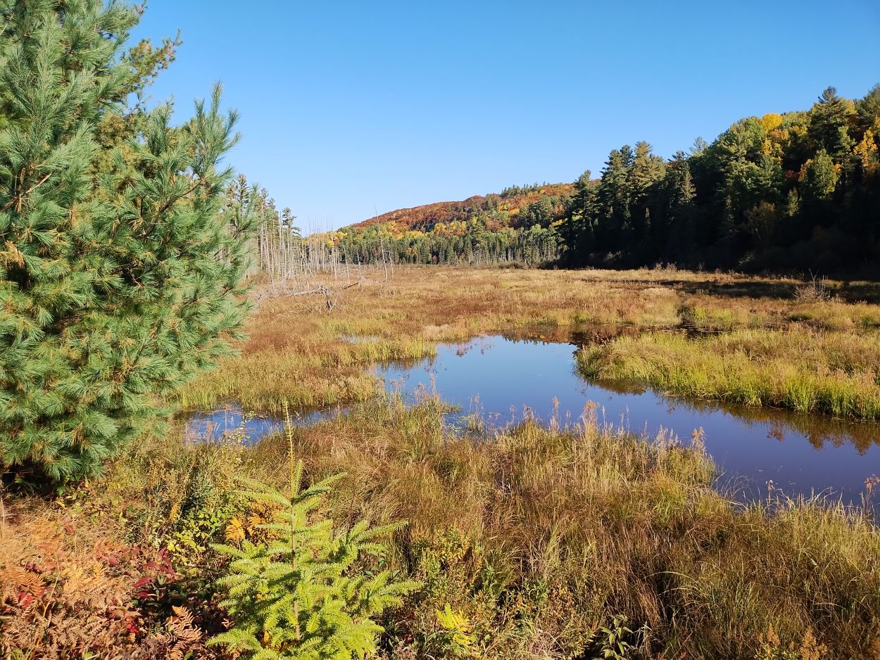
Looking north toward Rockpine Lake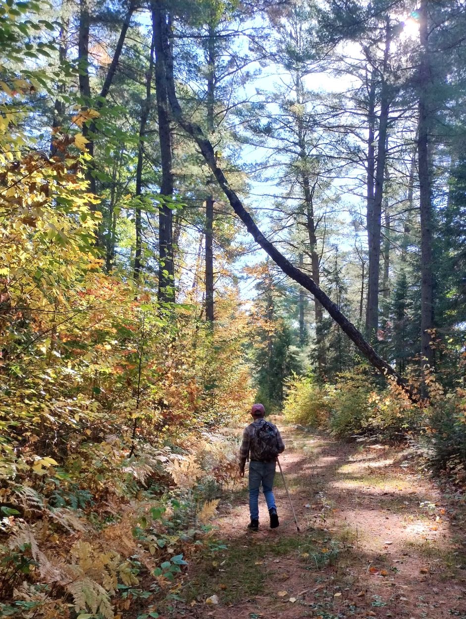
After several hours exploring, we started back. Here, passing through a really nice White Pine grove.
It's a steady climb from the valley through which the rail line ran back up to the Beechnut entrance to the park.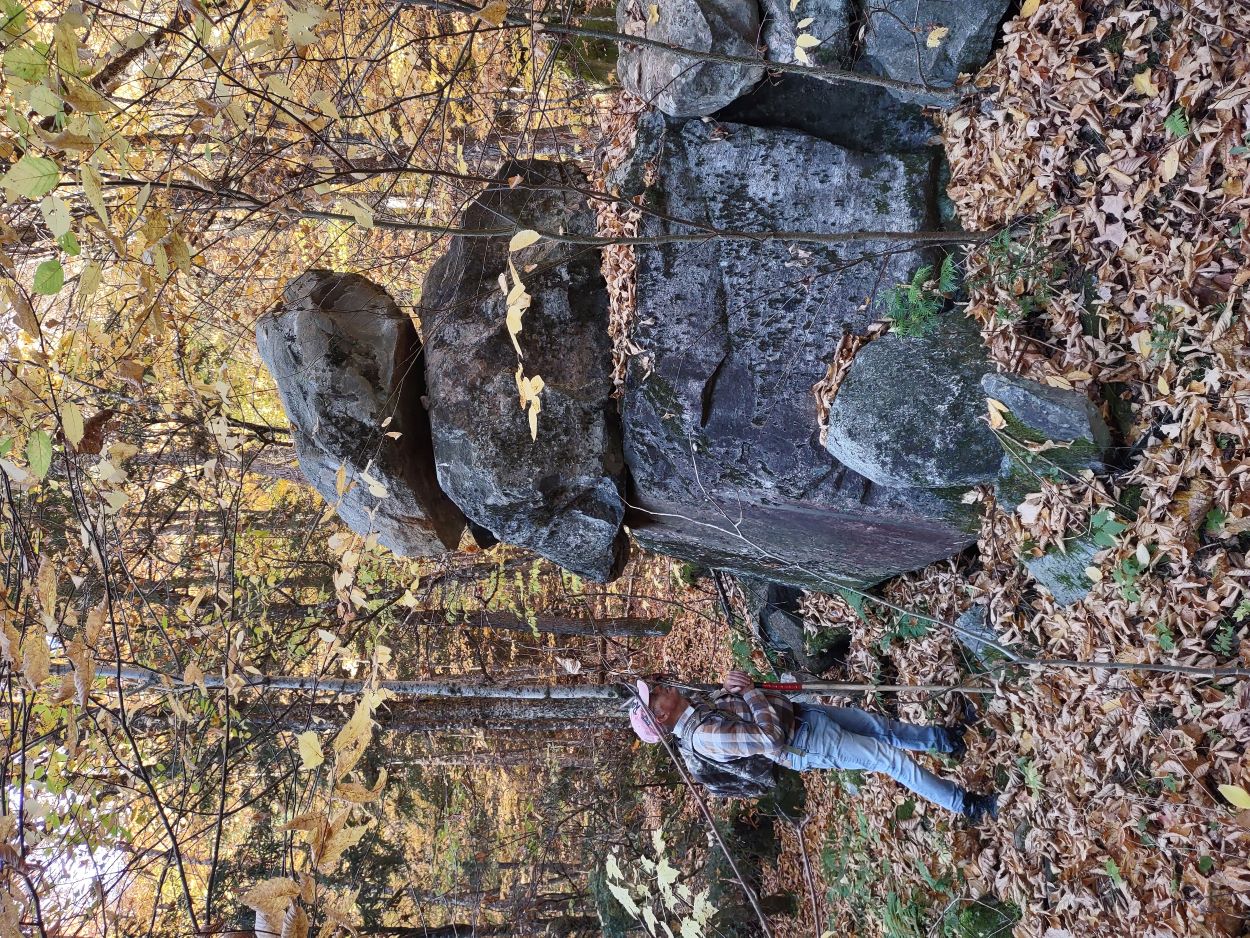
We happened to notice this rock pile off some distance in the bush. 
Our route: approx. 12 km return. The day had started out cool but in the afternoon the temperature rose to 29 degrees; a record high for Oct. 5.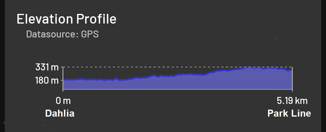
The return journey from Dahlia back to the park line at Beechnut Lake involves a steady climb of 151m (495 ft) over a relatively short distance.
_________________________
This report is also available on our website: Algonquin Park Day Hikers
Last edited by Trail (10/11/2025 9:43 am)
![]() Offline
Offline

I walked in up the removed tracks around 09 to fish Reserve, Rockpine, and Grove lakes. Wow the line is closing in fast.
![]() Offline
Offline
Wonderful depiction of the day. Thanks for posting.
![]() Offline
Offline
What a great adventure. Thanks for sharing this great write up.
![]() Offline
Offline

I was in the same area that weekend camping in Bonnechere PP and hiking around Depot lake and the cabin there. Inspired by your earlier reports. Also enjoyed a nice drive down highway 58 not knowing there was hiking nearby. And yes it got quite warm!!!
Great report as always!!
Last edited by oldboyscout (10/14/2025 1:28 pm)

 1 of 1