


![]() Offline
Offline

This was our third attempt to reach Aurora Lake. On our first attempt in October, 2024 we were blocked by a wide, flooded marsh along Basin Creek. We tried again on Jan. 10, 2025, and were able to ski across the frozen flooded area but found that the logging road we had hoped to use to reach Aurora is now too grown over to use as a ski trail.
This third attempt took place on Jan. 24, 2025. We planned to ski most of the way along a route suggested by Peek and Martin G. We would make our way to the point where Basin Creek enters Foys Lake, and then follow the creek across a series of ponds to a point as close as possible to Aurora. From there we would have to leave our skis and bushwhack through forest over to the lake.
We got an early start and by 8:00 AM were at the start of the cart trail to Foys Lake. The temperature was -23 C (-30 wind chill).
There had not been much snowfall in the two weeks since we last skiied in so we were able to use the track left from our previous trip. Not having to break a new trail saved a lot of time. Deer and moose had also made use of our trail. The trees were covered with hoarfrost. The ice crystals sparkled in the morning sunlight.
At -30 C it took longer than usual to get warm enough to be comfortable. I've never had much success when it comes to trying to minimize the amount you sweat on such a trip, especially with a pack on your back. But we did try to maintain a pace that would not make base layers too damp. 
We left the Foys Lake cart trail close to Basin Creek. Prior to the trip we had studied this Google Earth image (dated April 2013) to get a sense of the route of the main flow of the creek. With the very cold temperatures experienced through most of January the entire area is completely frozen over with no sign of open water. Even so, we took extra care in crossing places where we suspected we were close to the main channel. We were able to follow our old ski trail over to Foys Lk.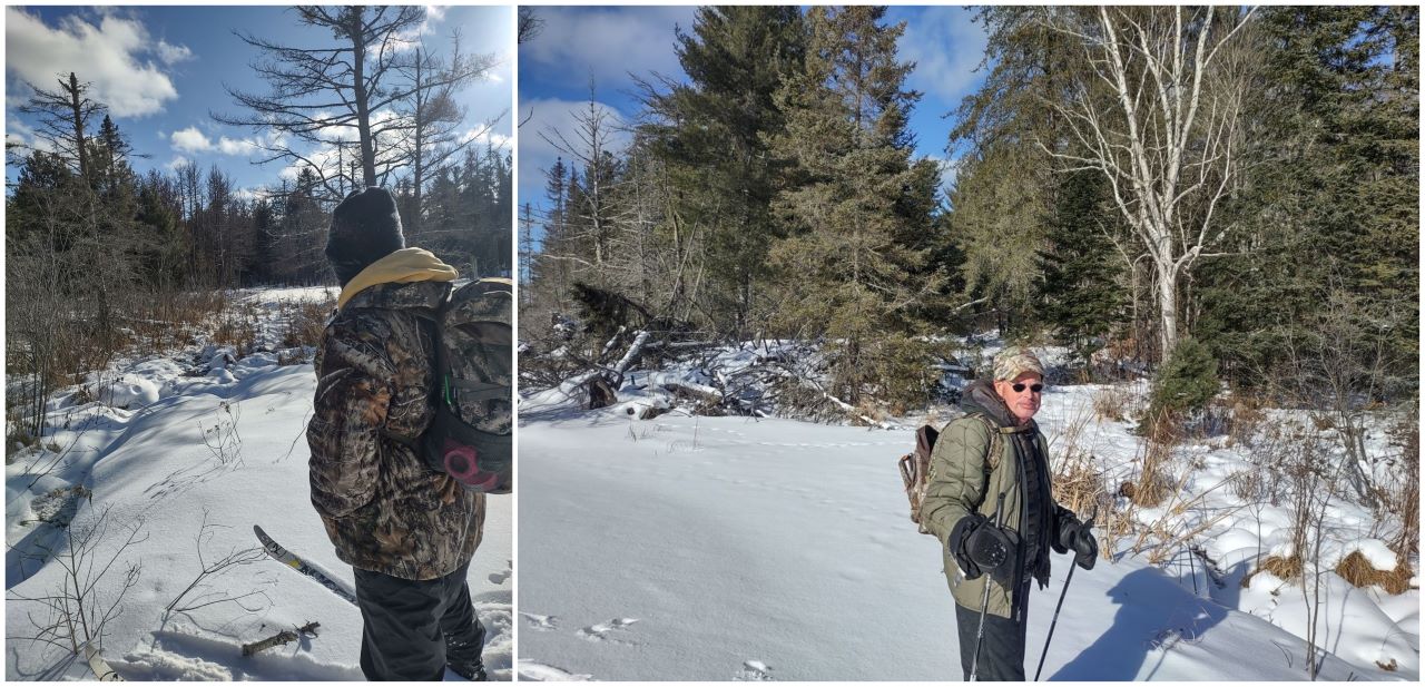 We paused at the creek to admire the industriousness of beavers. They have built a dam over a long distance along what was the logging road. At a height of about 4 feet it holds back a large body of water along Basin Creek.
 Below the beaver dam there is a wide marsh. Beyond the marsh the creek narrows as it flows to the northeast of Frog Lake, then south to Basin Lake, and finally into the Bonnechere River.
 Here we are on Basin Creek heading toward Foys Lake.
Our intended route -- Google Earth image. In October, Peek and Martin had camped on Basin Lake for a few days. During that trip they paddled up Basin Creek. After reading about our effort to reach Aurora Lk they suggested skiiing up Basin Creek from Foys Lk might be an option to consider. They did note that there was a thick wall of alders, and perhaps a beaver dam, at the point where the logging road to East Alder Lk crossed the creek. If we got past that point our plan was to get onto a series of ponds that would get us cloer to Aurora, and bushwhack from there. While there was no sign of open water on the creek, we kept to the shoreline and the marshes that line the creek.
 The wind had blown this stalk of grass back and forth, etching an arch in the snow. Combined with the shadow of the grass it looked like a sundial.
 The wall of alders we had been told about. This picture was taken looking back, after we made had our way through. This was the only place on the trip where we did encounter some open water.
  Here, too, beavers had made use of the abandoned logging road and used it as a base on which to build up a dam. We were able to find a spot to ski over it.
After getting through the alders and over the dam, we were onto a series of wide ponds that made for easy skiing.
The creek turns to the east, taking us in the direction of Aurora Lk. It was slower going here since we were breaking a trail.
This was as far as we could go on skis. We changed from ski boots and prepared to bushwhack. The distance from this point to Aurora is just over half a km (540 m). But we knew it would be slow going because of the depth of the snow and the fact that we would be climbing uphill to a point above the lake. Also, we would not likely be able to follow a straight line. 
Heading up the hills. We did come across a moose track which we were able to follow for some distance. We could see the spot where it had bedded down for the night. While following his track made walking a bit easier it meant we were creating a very winding trail. 
It took us about an hour to get to this opening which is what remains of the abandoned logging road that we had hoped to hike in on back in October. The road does appear on Jeff's map (see below). It does look as though some sections of the route could still be used for hiking.
The snow had drifted into this open area and was quite deep. I had never been in this Aurora Lk area, but my brother, shown in this picture, recalls driving to the lake on this road 40 years ago in the summer of 1985.
Map courtesy of Maps by Jeff.
It didn't take long to make our way down onto Aurora.
Aurora Lake looking south.
Looking north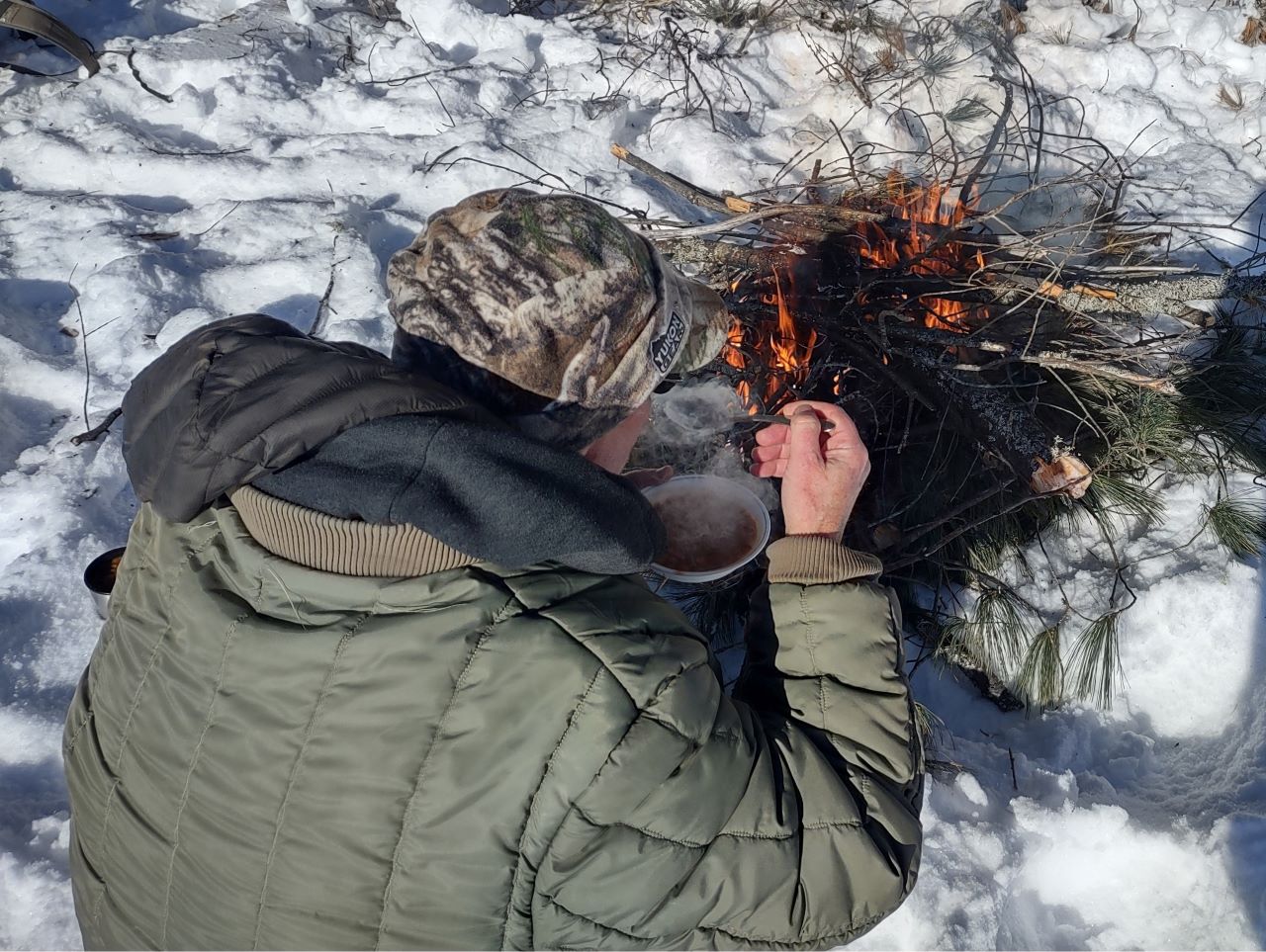
We made a fire to keep hands warm while eating lunch. Beans from a thermos -- still hot.
Time to pack up and head out. It was at this point that my brother noticed he had sliced open one of his rubber boots somewhere along the route.
We're back on skis and following our track out.
Coming out onto Foys Lake we were concerned there might be a strong northwest wind blowing. But it was calm and while it was still a cold day the sunlight had at least some warmth in it.
The final stretch -- back on the cart trail and a route we know very well now.
Our route
Start Time: 8:15 AM Finish: 2:20 PM
Distance Covered: 13.52 km
Historical Notes:
In Spirits of the Little Bonnechere, Roderick Mackay notes that a 1932 map shows a ranger cabin on Foy Lake. The cabin was connected by a single-wire bush telephone to cabins at Robitaille Lake, Milldam, Basin Depot, McKaskill Lake and the ranger station at Round Lake.
I have not seen any reference as to how Foys Lake got it's name, but I suspect it may be named after Peter Foy (1824-1890). He was an early settler who, in 1863, built a farmhouse and barns beside the Bonnechere River below Round Lake. His home served as a stopping place or hotel for lumbermen, teamsters and agents for the logging companies. It had stabling for 34 teams of horses, and was on the route to "The Basin" and at the centre of a thriving lumbering industry. Peter Foy also served as the postman for the community which came to be named Tramore. He was buried at the small Anglican cemetery located just above the Bonnechere River near the Tramore bridge.
Source: Peter Foy profile
![]() Offline
Offline

Thank you for the fantastic report and awesome photos. Enjoyed following your adventure and appreciate the maps and imagery. Happy to read that you made it to Aurora Lake!
![]() Offline
Offline
Looks like another great trip. Thank you for the post!
![]() Offline
Offline

That's an awesome trip and trip report! Thanks so much for sharing your journey with us!
![]() Offline
Offline
That is quite beautiful. Thank you so much for sharing your trip report and photos. Made me want to go winter camping, right up until I saw the ice in your beard in the very first photo.
But again, thanks for sharing. These are some beautiful photos of the park in a way we seldom get to see it.

 1 of 1