![]() Offline
Offline

Peek, Smedlyco and I did a 5 day one way traverse from Wendigo Lake to Big Bissett Lake by way of some bushwhacking, a logging road and the long discontinued creek route between Reed Lake and Big Bissett Lake. Bob and Diana McElroy met up with us on Big Bissett Lake for the last night.
Day -1
On Thursday night we were all chomping at the bit to get out of the daily grind and into CAAMPING. So, we split from work early and all met up at access point Bi2 “Bissett Creek Falls”, just outside the park. There are a couple of decent crown land campsites at this access point. Scott arrived first with his truck and home built canoe rack which was necessary to shuttle two boats to the Wendigo Access Point early the next day. Then Peek showed up in his Mario Cart and I arrived 10 minutes later in my Outback. Later in the trip it would prove critical that we had a second vehicle capable of handling a very gnarly road.
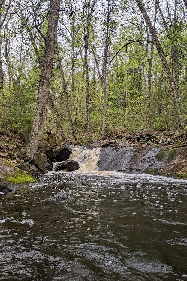
We took a short walk down the rivers edge through a series of rapids to a waterfall. A very rugged and pretty area, reminiscent of the terrain you encounter along the lower Petawawa. The bugs were out along the river and just starting to bite. We walked back to camp and quickly set a smoky fire to keep them at bay. Then we proceeded to enjoy tall boys and snacks, and caught up around the fire before each of us crawled back into our respective vehicles and crashed for the night.
Bissett Creek Falls
Bissett Creek Falls
Day 1
We were up early, and had a bit of a hang over. Breakfast on Scott’s tailgate was coffee, Pop tarts and assorted bars. We then made the early shuttle to Wendigo Access Point. Wendigo was surprisingly busy and surprisingly buggy. Time to re-assess your choices in life buggy. There was a group of 8 middle aged guys just setting out while we were getting unloaded. They were hurrying around excitedly and looked like they were getting ready for a great weekend. One of them asked if I could take a picture of the group. I obliged. He then told me they were heading to Radiant for the weekend and asked where we were headed. I said, “into the wild.” He looked at me cockeyed like I didn’t have a clue. “You know this is Algonquin, right?” Not exactly wilderness. Shortly after, they took off like a rocket. I wonder if they thought we would be racing them to Radiant? Next up on the boat launch was a couple with a nice fishing boat with a 20 horse. I tried to see if we could bum a lift to the Allan Lake port. They laughed and headed North. Oh well, I guess we are here to go paddling.
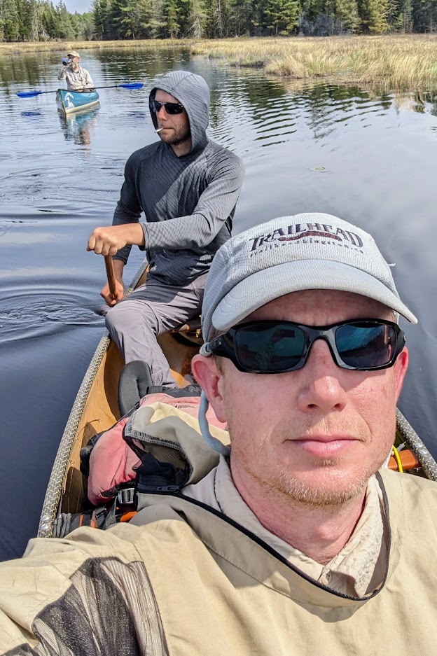
The start of the day was uneventful. It was beautiful, buggy and hot. We cruised quickly through Wendigo, Allan and North Depot. The only memorable port was the 770 from North Depot to the North River. It is a bit of a bugger. Luckily Peek took the boat for the whole carry. Peek is a tank on a portage. Scott also single carried with his full load and the heaviest solo pack boat I have ever lifted. It was a rented Swift Keewaydin 15 Pack Canoe in Kevlar Fusion. BS that was Kevlar Fusion. It was waay heavier than my Keewaydin 16’ Kevlar Fusion Tandem. Scott grunted through the rest of the trip with what seemed like a hundred pound solo boat.
It was only when we got to the 1.9km portage from the North River to Black Bass that the reality of this port sunk in. It went up 97m in the first 1km. It is a beast! Only slightly less steep than Heart Attack hill between Little Nadine and Little Osler. While not quite the grade of Heart Attack Hill, Black Bass is twice as long. And it was 34 degrees Celsius. This portage kicked our butts. It took hours and I’m pretty sure I had heat exhaustion by the time we were done. I felt awful. Even Peek’s awesome dinner of steak and fresh veg couldn’t help me shake the pukey weak feeling I had all afternoon and evening. I’m getting too old for this stuff.
Black Bass Lake. Unless you are on a mission to do something weird like we were, there is no reason to visit Black Bass Lake. The lake is small, nondescript, tannin stained. The first campsite on the west shore is garbage. One of the worst I have come across in Algonquin. It is also not where it is marked on Jeff’s Map. It is on the point south of the portage. Not that it matters. It’s garbage. Don’t go there. The other campsite on the opposite side of the lake is OK. It was flat had enough tent spots and a new thunderbox. If the stupid bushcraft furniture was dismantled and the site was cleaned up a bit, it might even be pretty good. But, again I can’t see any reason to come to this dead end lake unless you plan on bushwhacking further east.
The heaviest solo boat in existence
Someone was ambitious on North Depot
Tank Peek
Evening on Black Bass
Day 2
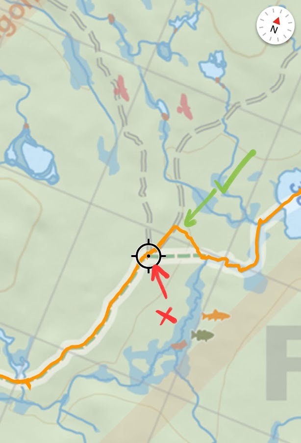
We were up early again, had a quick breakfast before getting on the water for a 200m paddle to our first portage of the day. We were planning to do Route 99, published on the 1974 Friends of Algonquin Map.
It's hard to say when the route was officially discontinued. The last time parts of the route were published by the Friends of Algonquin was the 1995 map. Even then, the first stage of the route was not on the map. The first stage includes a 275m bushwhack to a logging road, followed by a 3km portage on the logging load, and finally a 350m bushwhack to North Bissett Creek.
We quickly found what looked like the old portage landing on Black Bass Lake. The trail from there disappears quickly. For the most part the walking is easy through a mature hardwood forest. It becomes messy as you get close to the road where the mature hardwoods are replaced by raspberry cane and logging thrash. The logging road provides a very easy walk. It is a clear and well used road. Also, clearly an animal highway with plenty of wolf, bear and moose tracks. At the far end of the logging road we were confused for a while. We stopped at a Y junction. On Jeff’s Maps this junction is also where an old portage branches away from the road towards North Bissett Creek. The area had clearly been logged years ago and now presented a combination of young growth, Alder, Raspberry cane and logging slash. Bushwhacking through there looked like a nightmare. Turns out Jeff’s map is marked incorrectly. The actual portage offshoot is another 300 meters down the road. A combination of logging activity, hunters and snowmobilers have kept this a wide and clear trail leading right to the creek.
North Bissett Creek offers a beautiful and easy paddle into Weasel Lake. Weasel itself is a small but pretty lake. The southern campsite seems to get some use. Probably illegally via the creek access. It is rough and surrounded by downed trees. It has a firepit, assorted tables, frying pans and pots scattered about, but no Thunderbox. I hooked into one fish on Weasel but it quickly shook the lure off. Fishing in general was slow. Probably because of the heat, also because we were not stopping to fish. Instead just dragging a lure behind the boat as we travelled.
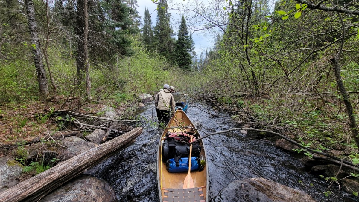
The creek between Weasel and Bisset was a little more difficult to paddle. It starts out wide and open but quickly narrows down to barely a boat wide. We kept a sharp eye out for the old portage entrance but saw nothing. Travelling further down, the creek opens up again into a wide marsh. Still no sign of a portage entrance. We continued to the first rapid. At this point I went into the forest south of the river looking for a sign of the old portage. I couldn’t find anything amongst the thick tangle of trees and blow down. Instead of exploring further we creek walked the first rapid. Shortly after passing that one, we reached a second rapid. At this point the creek constricted considerably. The forest encroached on it and there were numerous trees down over the creek. Scott searched north of the creek for signs of a trail and Peek searched south. After a short while Peek found the portage. A steep and messy bushwhack brought us to the old trail. It was wide enough that it could have been a road at one time. But it was littered with downed trees and clearly hadn’t seen much use in decades. We followed it to Bisset Lake where is ends in a very old and sunken log trailhead that empties into a boggy part of the lake.
Bissett is a beautiful but seemingly shallow lake. We beelined for the island campsite arriving in the early afternoon. This is a wonderful spot. Judging by the fire pit and overall impact it may see one or two paddlers a year. If it weren’t so difficult to get to, I would make it a regular destination. It is flat, offers great protection, has a decent firepit with benches and an open grass and rock landing with great exposure to the lake. Late afternoon the sky started to look very ominous. For about an hour we were treated to non stop show of lightning and thunder. When the slow moving storm finally got to us it brought rain and wind but nothing torrential, not enough to put out our fire. We dubbed the island Thunder Island and enjoyed dinner and drinks well into the evening before retiring to our tents for a sound nights sleep.
Note: I didn't take many pictures on this day. Hopefully Peek and Scott can add something.
Campsite on Bissett
Watching the clouds roll in
Evening approaches
Full moon on Bissett
Day 3
This was a short easy day. We paddled from Thunder Island on Bisset Lake to Reed Lake, where we would dump our gear before paddling on to take a tour of Fitz and Gerald Lakes.
The fist 155m portage of the day runs along side the small rapids leaving Bissett Lake. It doesn’t get much traffic. It is easy and flat and had that wonderful morning smell that comes with dew, pine and moss. A short paddle on a beautiful wide creek brings you to the next portage. This is marked on Jeff’s Maps as a 1.5k portage starting where North Bissett creek takes a sharp turn to the Northeast. The portage actually starts well upstream of this point. About 300 metres into your carry, you walk across the creek that Jeff’s maps shows is at the start of the portage.
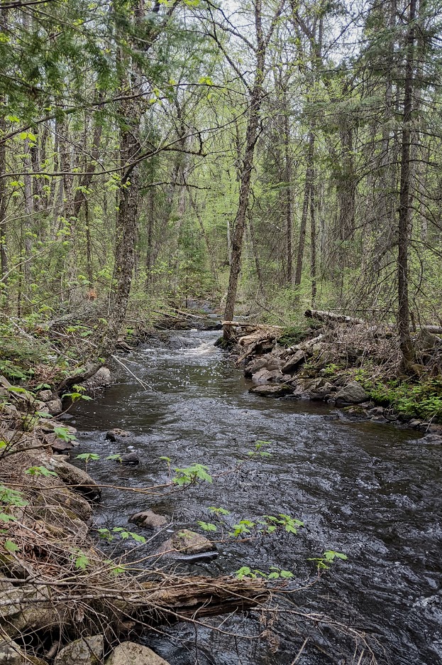
After crossing the 1500m portage we turned right and started paddling up Bissett creek. We immediately had to haul up a small rapid and beaver dam before getting into a wide marsh. The marsh is very pretty and full of Red Wig Blackbirds and Warblers. There is supposed to be a campsite on the south side somewhere along the route, but we saw no sign of it. The creek exits the marsh and narrows down into a reed chocked stream that would be impassable in low water. This narrow winding reedy stream carries on for about 100 metres before ending at the portage to Reed Lake. This portage is also beside the remnants of an old logging dam. The old logs and spikes are still visible just under the surface of the water.
Like all the portages we have crossed they are not travelled much. Lots of blowdowns covering the trail. Only the occasional sign, or remains of a sign. Reed Lake has crystal clear water, but it is also full of leaches. Reed is a small nondescript lake with a Black Spruce Swamp at the north end. At the south end is a lift over into Fitz Lake. Another small unassuming lake. As you continue south note the portage to Gerald is about 75m east of where it is shown on Jeff’s Maps. It’s funny how we rely on maps and GPS instead of common sense and reading the land. We went exactly to where Peeks GPS told us to go. Clearly other people had been here too. There was a rough clearing where people had pulled their boats up. Peek and I bushwhacked around for a bit and found some old flagging tape but nothing resembling a trail. Instead of exploring the woods with us Scott kept paddling East to where the creek from Gerald empties into Fitz Lake. This is where the clear and obvious portage is. Exactly where you would expect it to be.
Gerald is another small , clearwater but otherwise nondescript lake. The campsite on Gerald is high above the lake on a point. It is a so so site. The campsite between Fitz and Reed is on the remnants of an old road. It is flat and has a firepit but otherwise it’s on the ugly remnants of an old road and there is no view of either Fitz or Reed Lakes. The campsite on the island on Reed is decent. Someone has put a lot of work into the Fire Pit making it one of the best cooking fires I have seen in Algonquin. At some point in the recent past there must have been a severe wind event that hit the island as hundreds of trees are down, littering the island like matchsticks.
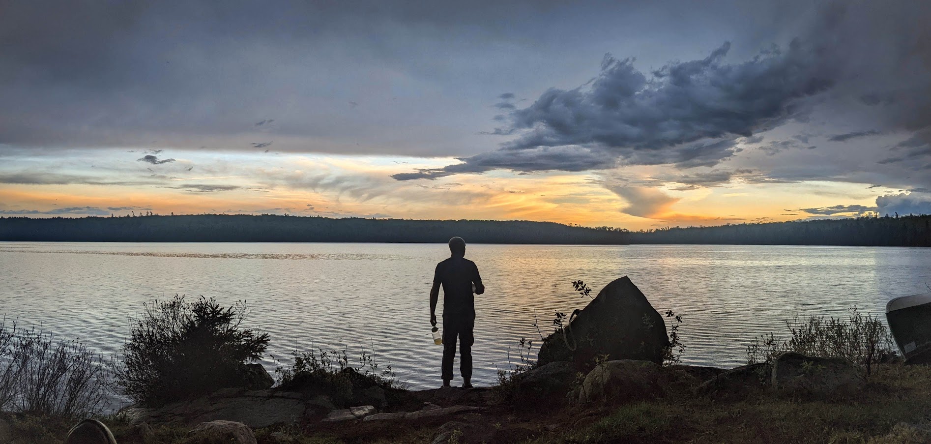
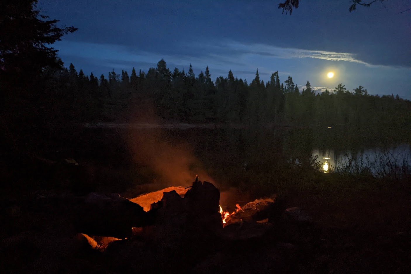
I went out for an evening solo paddle caught 2 very small Lake Trout and caught an amazing sunset. Later that night we also took in a breath-taking full moon rise. I took several pictures of it. Later that night just before bed I remember looking at the moon again and noting it now looked like a crescent. I didn’t give it much thought, maybe some cloud cover was rolling in and obscuring the moon (I didn’t have my glasses on). Scott and Peek had already turned in for the night. I turned back to the fire as the flames and embers died out. Little did we know we were missing a total eclipse of the Super Flower Blood Moon. A red cast caused by the light scattered by Earth's atmosphere, which inspires the blood moon moniker.
North Bisset Creek
Scott getting ready for the 1500
Manly man
Steamboat
Bissett Creek Marsh
Campsite on Reed
Little Laker
Sunset
Moonrise
Day 4
Mooses
A couple of moose woke me up by walking beside our site first thing in the morning. Always a great way to start the day! While this day had a lot of unknowns we were really looking forward to the creek. While we only had 13 kilometres to travel, we were half afraid that we weren’t going to make it. We were prepared to set up alongside the creek if we had to. Satellite imagery shows the creek is open but there are 9 historic portages along the route. None of them had seen official park maintenance since some time in the 90’s.
1974 map
The first port out of Reed was a repeat of the day before. We backtracked through the marsh and past the portage to Bissett Lake. Throughout the mornings paddle we were surrounded by Spring Peepers, Chorus Frogs, Red Wing Black Birds and then we heard the deep glugging cough of a Bittern. If you didn’t know what you were hearing anyone would be baffled by the bizarre sound a Bittern makes
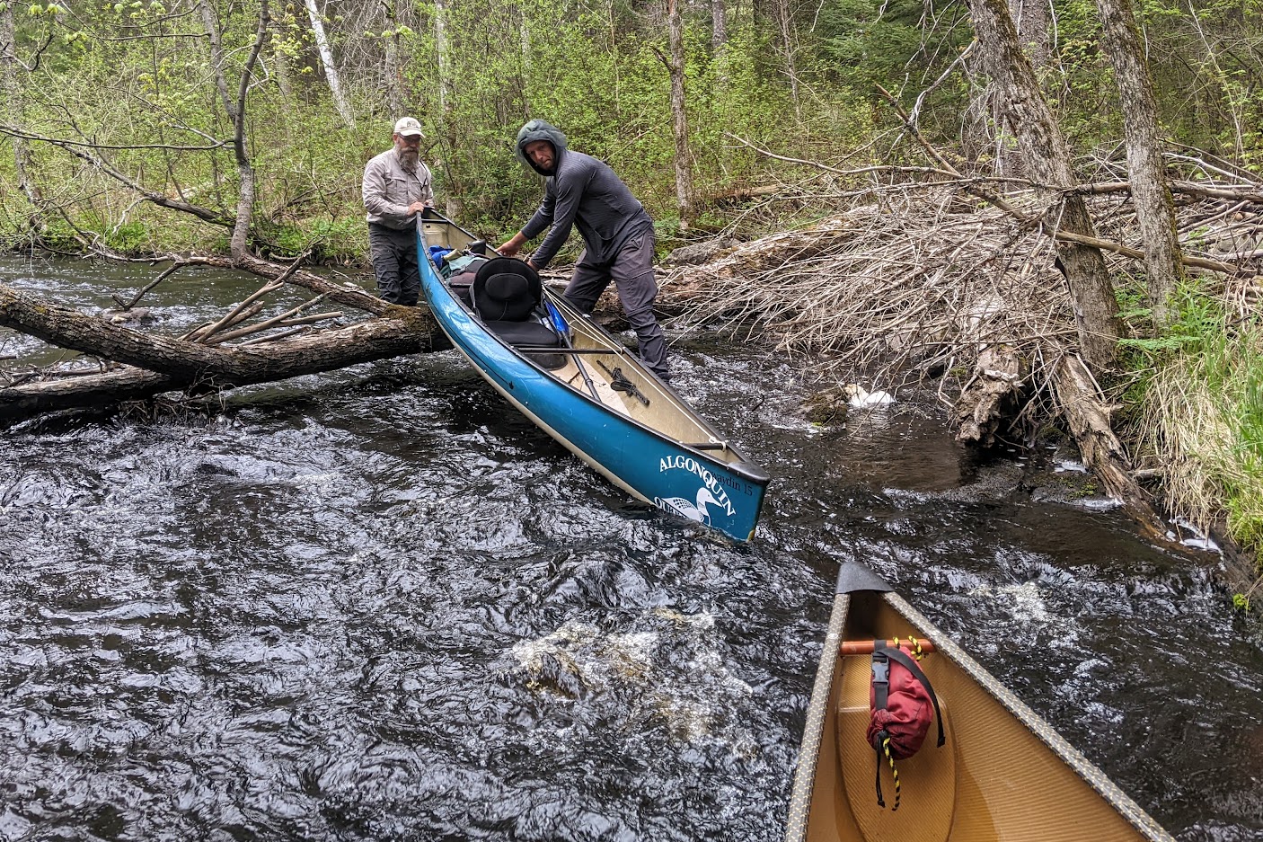
We came upon the first portage east of Bissett lake quickly. We looked to the shore on the south side of the creek but found no sign of a portage entrance, so paddled down to the head of the rapid that the portage bypasses. It looked straight forward. Basically 250 yards of wading through light rapids to get through to calm water. Easy Peasy! The next portage along the creek was a repeat of the first. Again, we waded through the rapids for a while until there were too many obstructions to carry on. Then we pulled out and bushwhacked to a clearing and the end of the rapids. Once you got used to having wet feet it was fun! We were skipping a good portion of the portages; the terrain was relatively flat and the carries were through open hardwood forest.
Bissett Creek
Creek Walking
The third portage along the creek is more significant. It is obvious where the start is and there is no way to creek drag that one. It bypasses a significant drop and a series of small water falls though a ravine. The entrance to the old portage on the south side of the river is obscured by a large, downed Pine tree. 20 yards past that you find yourself on a very clear trail that is easy to follow for most of its length before it gets obscured by a series of downed trees. We even found an old portage sign at the east end of the trail. This was the only sign of any kind we found along the route.
Bissett Creek
Bissett Creek
Old Sign
The third carry was the last portage before a small lake opens up mid way through the route. As we entered the lake, we spotted a moose on the north shore that watched us for a while before trotting off into the Spruce trees. On the west shore of this lake is a small campsite. Or, what used to be campsite. It is now mostly unusable due to a couple of downed trees. The old portage leaves this site bypassing a short but significant boulder garden rapid. While it was short, this portage has been completely obliterated by downed trees, Alder and raspberry cane. It was the worst ‘carry’ of the trip since the trail between Weasel and Bisset Lakes. Shortly after that there are two back-to-back portages. One on the north shore and one on the south. We saw no sign of the first one and started by wading down a rock filled creek. We soon got stopped by a mess of blow down and had to pull out south of the creek. From here it is a messy bushwhack to get back to paddleable water.
The next portage is a doozy. Again the river drops significantly in this section and we found no sign of any old trails. Instead, we paddled and pulled the boats as far as we thought prudent before the rapids got too rough and the creek wound out of sight. We pulled out north of the creek and bush crashed past a series of very picturesque falls and rapids before getting back to calm water on the creek. At one point on this non-trail we discovered a boardwalk in very good condition. But there was nothing resembling a trail leading to it or leaving from it.
There were lots of downed trees blocking the creek
Dirty Creek
The last historic portage along the creek is a long one that crosses a modern logging road before ending where the creek empties into a marsh at the south end of Big Bissett lake. At the upstream end we saw a campsite on the south side of the creek. It may have been decent at one time. We didn’t get out to check it because it clearly had several trees down on it. This is probably where the final portage starts. Instead of getting out and looking for a trail we just paddled on. In retrospect this was a mistake. We should have looked for the trail. From here to Big Bisset lake the creek drops 50 metres. We walked and paddled the creek as far as we could until we had to bushwhack through rough terrain to get to the road. East of the road we managed to find remnants of the old trail. It has more downed trees obscuring its’ route but was easy enough to follow. It continues down a steep ravine before ending in an alder filled bog.
The only way to get through to the creek is to crash through the muck and Alder. When we finished the final portage of the day we had to hold off on any celebration. Bisset creek at this point was a winding alder choked creek with a mess of downed trees blocking our way. And it was raining. It seemed Bissett creek didn’t want to let us go. Maybe it missed paddlers.
It was late afternoon and raining steadily as we finished winding our way through the marsh and beelined towards our destination, two low maintenance campsites at the south end of Big Bissett lake. We could see that one was occupied. There was a red and white canoe and a yellow tarp up on that site. As we approached we saw someone stringing up another tarp on the second site. This was great news! We knew who was there. Bob and Diana McElroy () had arranged to meet up with us at this spot. Bob was stringing up the second tarp just for us to get out of the rain.
It had been nearly 5 years since the last time Scott and I had met up with McElroy’s. Even longer for Peek. Bob and Diana are experts on all things Algonquin and have been visiting the park since the 60’s. We have been conversing for a decade or more. I love the pictures, stories, history and humor they share through their website and I feel very lucky that we are friends. Even luckier on this rainy day because of the dry spot Bob had set up for us after a long tough slog through Bissett Creek. Diana also helped warm us up. She brought fresh baked brownies and orange-cranberry loaf to provide much needed calories. After changing into some dry clothes and gathering wood for a roaring fire we all ate dinner, enjoyed drinks and reminisced through another wonderful Algonquin night.
Day 5
We had originally planned to paddle further down Bissett Creek. Our cars were waiting for us about 13km away at Bisset Creek Provincial Waterway Park. But, it was pouring rain. We approached Bob and Diana to ask if they would mind helping us exit a bit earlier. We proposed that they drive us to our cars so we could finish our trip at the Big Bissett lake access point. Of course they were more than willing to help out. With one caveat, Bob said, “what kind of cars are you driving?” The road to the Bissett Lake access point is rough, VERY rough. It is the roughest road leading to any Algonquin Park access point. Peek has a car with 15” wheels and no clearance. There is no way his car could manage that road without causing some damage and most likely getting stuck. Bob wasn’t 100% percent sure my Outback could manage it. Bob and Diana drive a 4 Runner. It was just a bit of fun for that truck. As it turned out the Outback managed just fine. It only bottomed out once and the fancy X-Drive managed the steep, loose, rocky climbs. We got everybody and all the boats out with some creative shuttling.
To sum up our trip, we went in to the wild and it was awesome. As Peek would say, CAAMPING! The creek needs some love but if someone went through with a chainsaw they could make Bissett Creek great again!
Last edited by MartinG (7/26/2025 9:12 am)
![]() Offline
Offline

That is a bad ass trip and a bad ass trip report. Sounds like fun, except for the bugs and brutal portages. I remember eyeing Bissett Lake several years ago as it looked to be an interesting destination that's not easy to get too, but it's on the wrong side of the park and I just don't get enough "Algonquin time" for that trip to get on my short list. Bissett looks beautiful so maybe one day in the future I'll be lucky enough to make it there.
![]() Offline
Offline
Thanks Solos! It was a pretty great trip. It was nice to see some of the wilder parts of the park. The portages weren't that brutal but he heat sure was. I wish the park would maintain or reopen some of these old routes. Bissett, Rouge Lake, Bonnechere River. Take some of the pressure of other parts of the park.
![]() Offline
Offline
Very cool report. Looks like a fun adventure, I was also surprised how busy Wendigo is. Parking lot was full when I was there May 24 weekend. There is a graphite mine somewhere on Bissett Creek road as well. "Bissett Creek contains a very high percentage of large and extra large flake graphite which command premium pricing. An independent source has rated it as the highest margin graphite project in the world."
PS- that's a brook trout not a laker ![]()
![]() Offline
Offline
Thanks Lenny, the colours sure look like a Brook Trout, but the tail threw me off.
![]() Offline
Offline
What a fantastic trip report! Thanks for sharing that. Waaaaaay more adventurous than I would ever attempt.
By the way, thanks for sharing that link to the call of the bittern. What a screwball sound. I'm prepping a trip report presently, and you reminded me of a bird I heard on my first night out. I don't know what it was, I kept thinking it was a loon with a busted whatever-birds-have-instead-of-vocal-chords, but it sounded like it was dry-heaving. It was sort of making me nauseas listening to it.
![]() Offline
Offline
I could totally do this trip........in my dreams!
Or perhaps my nightmares - judging from some parts of your trip description.
Good on you guys for doing this old route. I totally agree that the Park should be reopening areas like this.
I really enjoyed reading this!
![]() Offline
Offline
Great write up Martin! Nice to read about intrepid adventures in farther reaches of the park. Also great to hear the McElroy's met up with you guys, I've long been a fan of their site. Particularly liked the moonrise photo.
![]() Offline
Offline
@Dave, Thamesman and Gord
Thank you for your comments! Im glad you liked my write up. Seems video has killed the trip report. But some folks still read and write the odd TR.
![]() Offline
Offline
What an awesome trip! Let's do it again!!
![]() Offline
Offline
Peek wrote:
What an awesome trip! Let's do it again!!
Next time don't forget the chainsaw!
![]() Offline
Offline
That's an interesting idea. You are allowed to use a chain saw in an area operated for interior camping after Thanksgiving. I wonder how that would apply to removal of 'safety hazards' on old portage trails?
![]() Offline
Offline

Great read and pictures Martin. You guys aren't messing around.

 1 of 1