Peek,
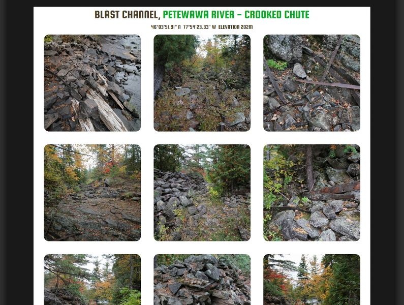
The photo you have in the "Blast Channel" section with the caption of "I don't know what this is, email me if you know" appears to be what is referred to as a "Pothole".
It's a geologic landform or remnant of erosion from very fast flowing water. Essentially it starts as a small depression in bedrock with a few pebbles or rocks laying on it. As water flows over it, the current creates a circular motion that carries the rocks around and acts as an abrasive - sort of a blend between sand paper (for small pebbles) and a jackhammer (for larger rocks). As they spin, they have the effect of acting like a massive drill. Googling "pothole landform" or "pothole erosion" will show many images of these features.
I believe they are most commonly associated with massive glacial outflows - areas where a glacial dam holds back a lake and then releases its contents in a short period of time. There are many along the length of the Susquehanna river in my back yard at a place called "Falmouth" http://www.dcnr.state.pa.us/cs/groups/public/documents/document/dcnr_008376.pdf and I have seen these in other areas such as Algonquin (formation of Eustache lake, the Barron Canyon are suspected to be the result of these glacial dam releases), I've seen them on the tops of the mountains of Acadia Park on the coast of Maine - with holes drilled into the very hard granite, which is quite impressive. They also appear in non-glacial areas where reliably fast water flows over bedrock.
Most are small - perhaps the diameter of 10 to 30 centimeters - but some can be massive at a meter or many meters across. For those you need some really catastrophic, biblical-type flooding to scour that hard and with that much power, energy and time.
Very cool features and your photo clearly shows the bunch of rocks in the bottom that were circulating in there for eons (or at least for the time that the heavy flow was over-running that area).