


![]() Offline
Offline
Back in March of 2024, just before ice out, we bushwhacked from Upper Pine Lake over to Grass-pink Lake. That day we did not have time to go further, so for this trip we planned an earlier start with the intention of going beyond Grass-pink and over to Little Tarn.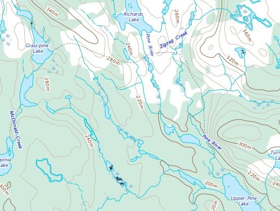
Historic route from Upper Pine to Grass-pinkSource: The Atlas of Canada, Toporama
On that hike we discovered that the portage from Upper Pine to Grass-pink that appears on some of the older maps is long grown over. In spring and fall there is a decent enough trail along Upper Pine but after reaching to top of the lake it is a matter of bushwhacking the remainder of the way. Our plan for this hike, after reaching Grass-pink, was to make our way over to the two short portages that lead to Little Tarn. 
We started out from Round Lake just before sunrise, and drove to the Pine River road which ends at the park line.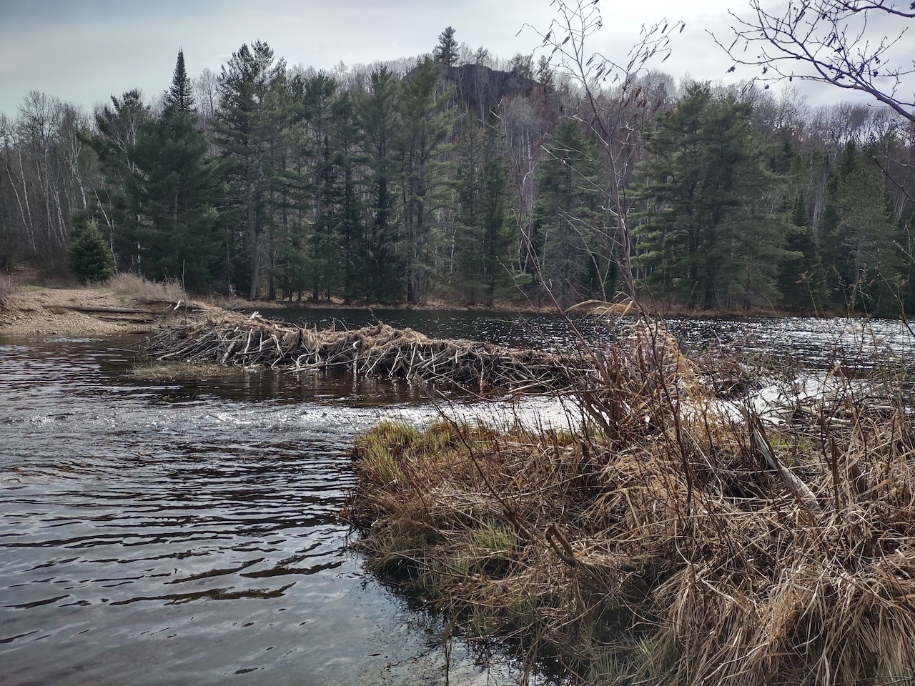
The road ends here at Pine River. In some years the beaver dam provides a way to cross the river but more recently there has been no option other than to wade across. We crossed the river at 6:30 AM.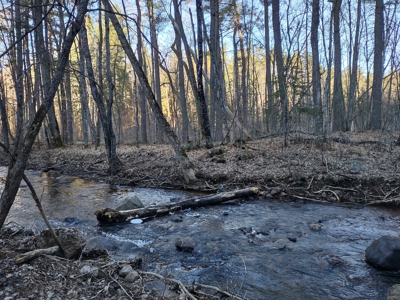
Above Upper Pine Lake you come to Zigzag Creek. The creek had already receded so we were able to walk along the edge for some distance.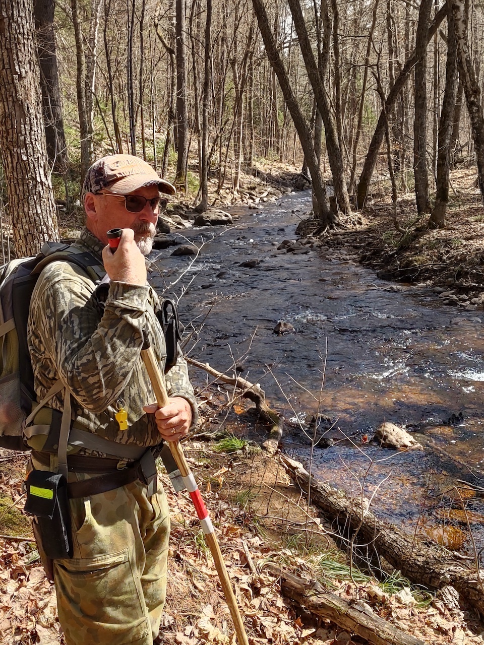
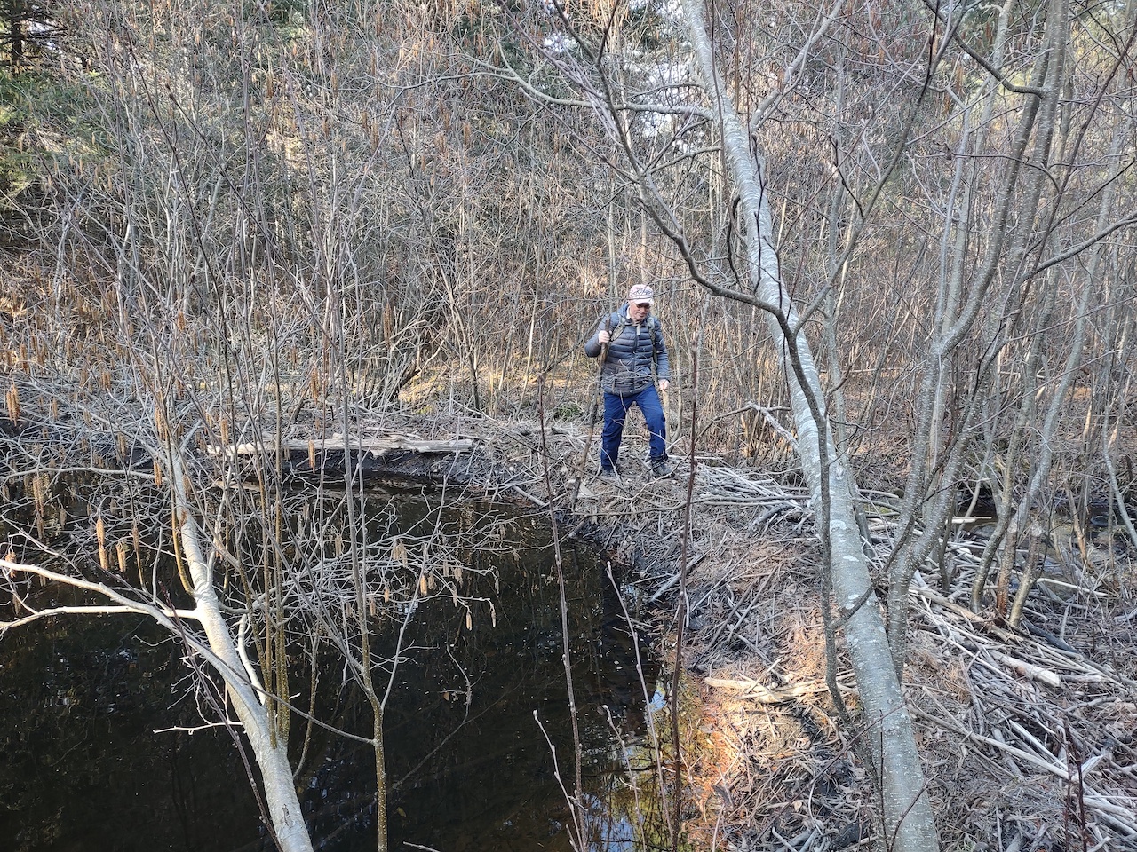
It seems every hike involves needing to find a beaver dam to get across a creek or swamp, and this hike was no exception.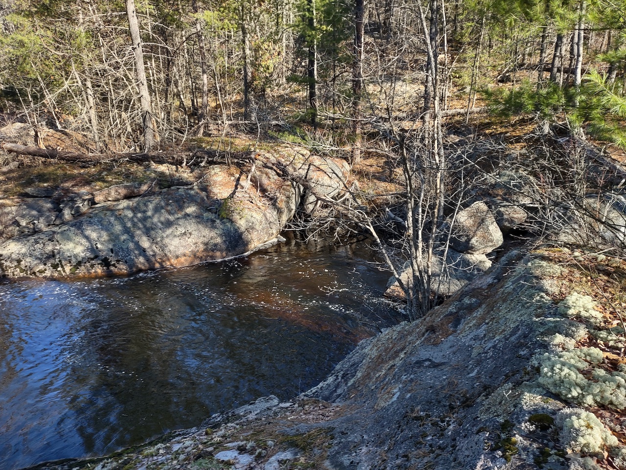
Travelling further north you come to a rugged area where Zigzag Creek flows down through rock walls and huge boulders. The original portage crossed the creek just above this point where beavers usually maintain a dam. We have used that dam to cross on previous hikes. However. this time there was a large gap in the dam which was too wide to jump across, so we had to search for another way to cross.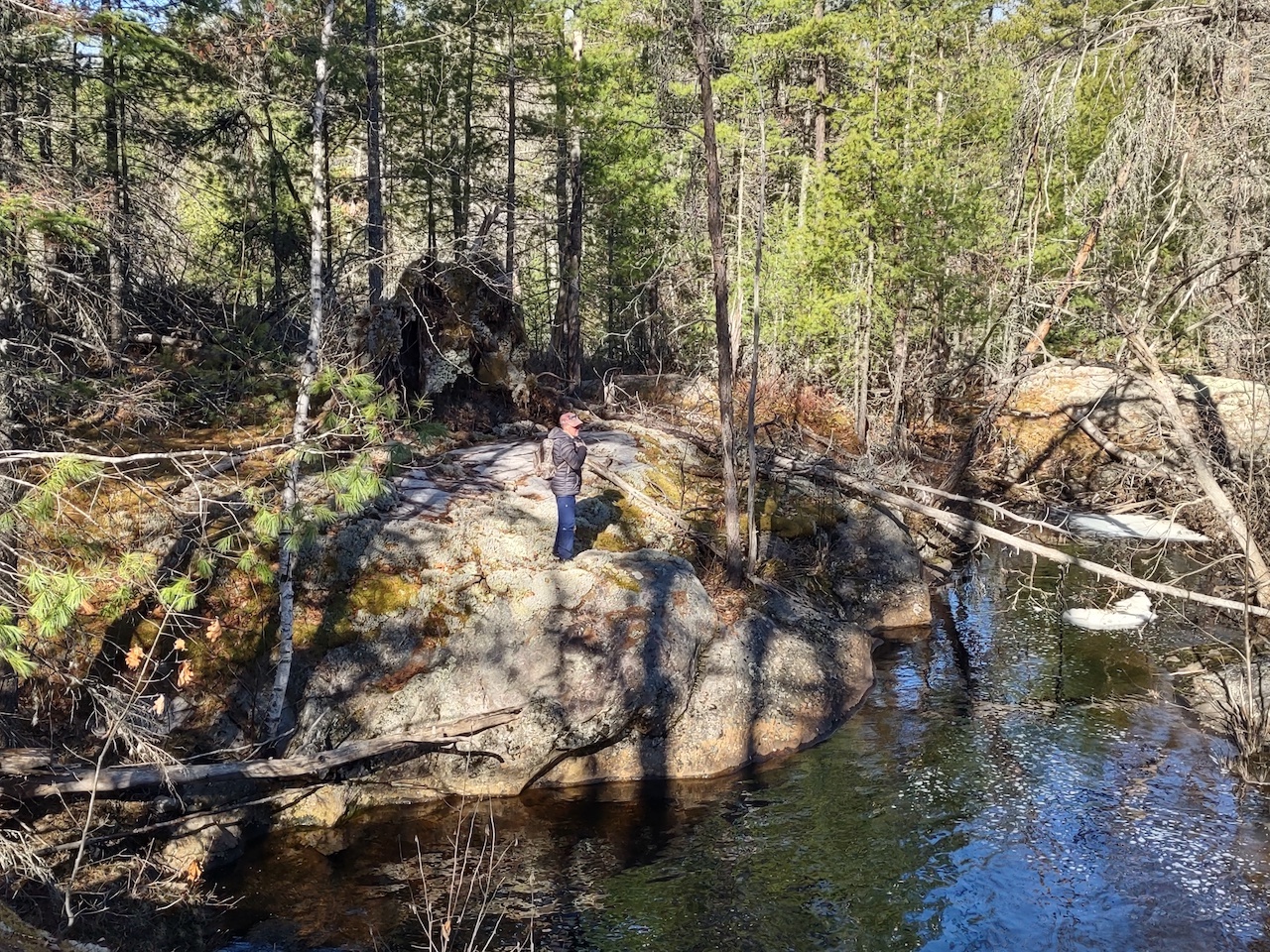
We found a spot along the creek below this rock in the photo where we could cross but I have to admit it was frightening. For two guys in their 70s, leaping across the spaces between several high boulders with water crashing 15 feet below your feet is not something you do every day. A short video of us looking for a place to cross. Video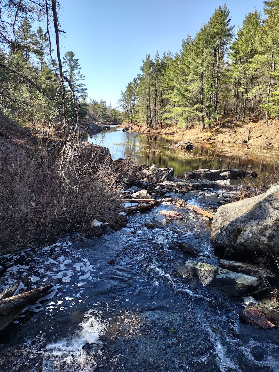
Heading west you come to Pine River. The river flows out of Richards Lake to the north, and from here it flows south, eventually entering the Bonnechere River. Travelling on from this point you begin a steep climb toward Grass-pink. While we did find one or two signs of the original portage prior to this point, after reaching Pine River we could find no sign of a trail. 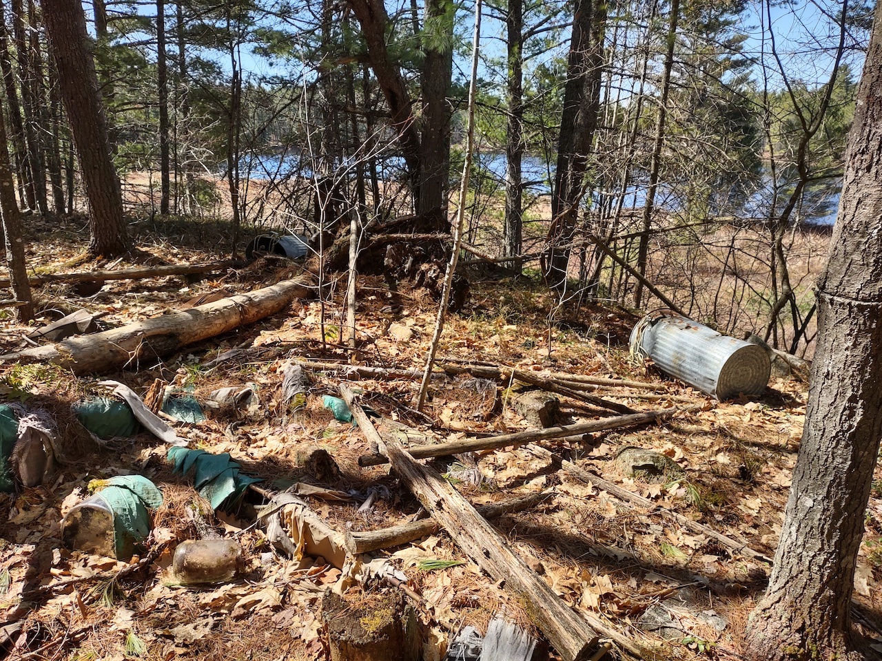
This was a surprise and a disappointment. Bushwhacking from Pine River, we were aiming to come out toward the north end of Grass-pink. You can see the lake in the background of this photo. Approaching the lake we came across this long deserted camp site with debris scattered over a considerable area. The amount of vegetation and deadfall lying on top of the debris would indicate the site has not been used for many years. There was also an abandoned canoe at the site. We recorded the coordinates of the site and plan to contact the Ministry in the hope that a clean up might be organized.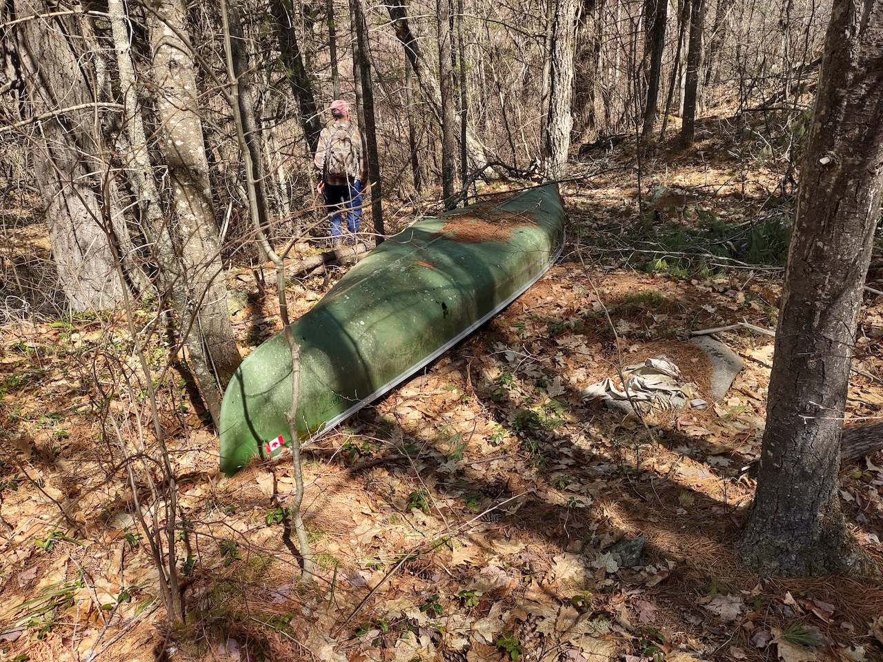
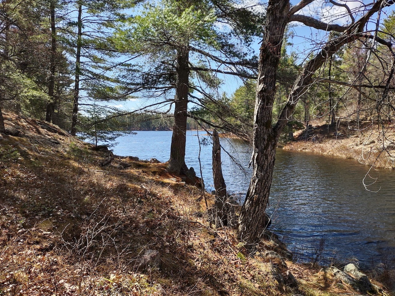
Working our way up the lake, we came to the narrows at the north end of Grass-pink.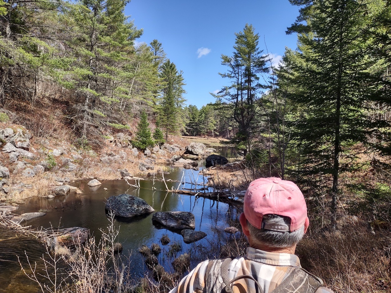
There is a short portage here (50m) to get past this rocky area. 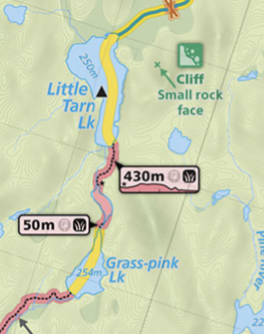
Map courtesy of Maps by Jeff.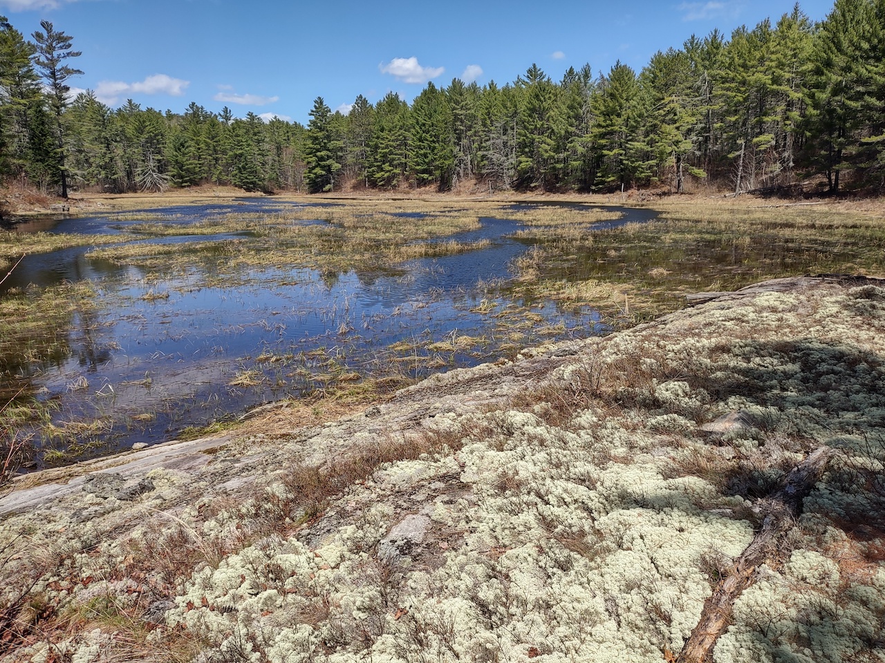
The pond between Grass-pink and Little Tarn. We were able to walk along the edge of the pond to the curve in the river seen in the distance in the photo. Around that corner you come to the 430m portage to Little Tarn.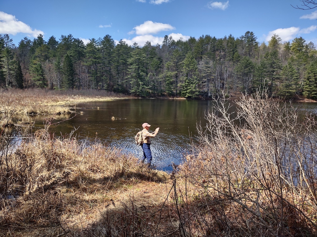
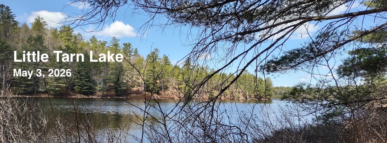
After 5 hours of walking, we arrived at Little Tarn at 11:30 AM.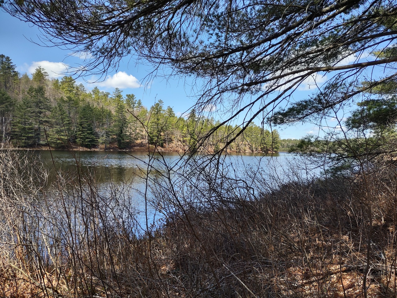
Little Tarn Lake. The one campsite on the lake is located at the point on the far shore.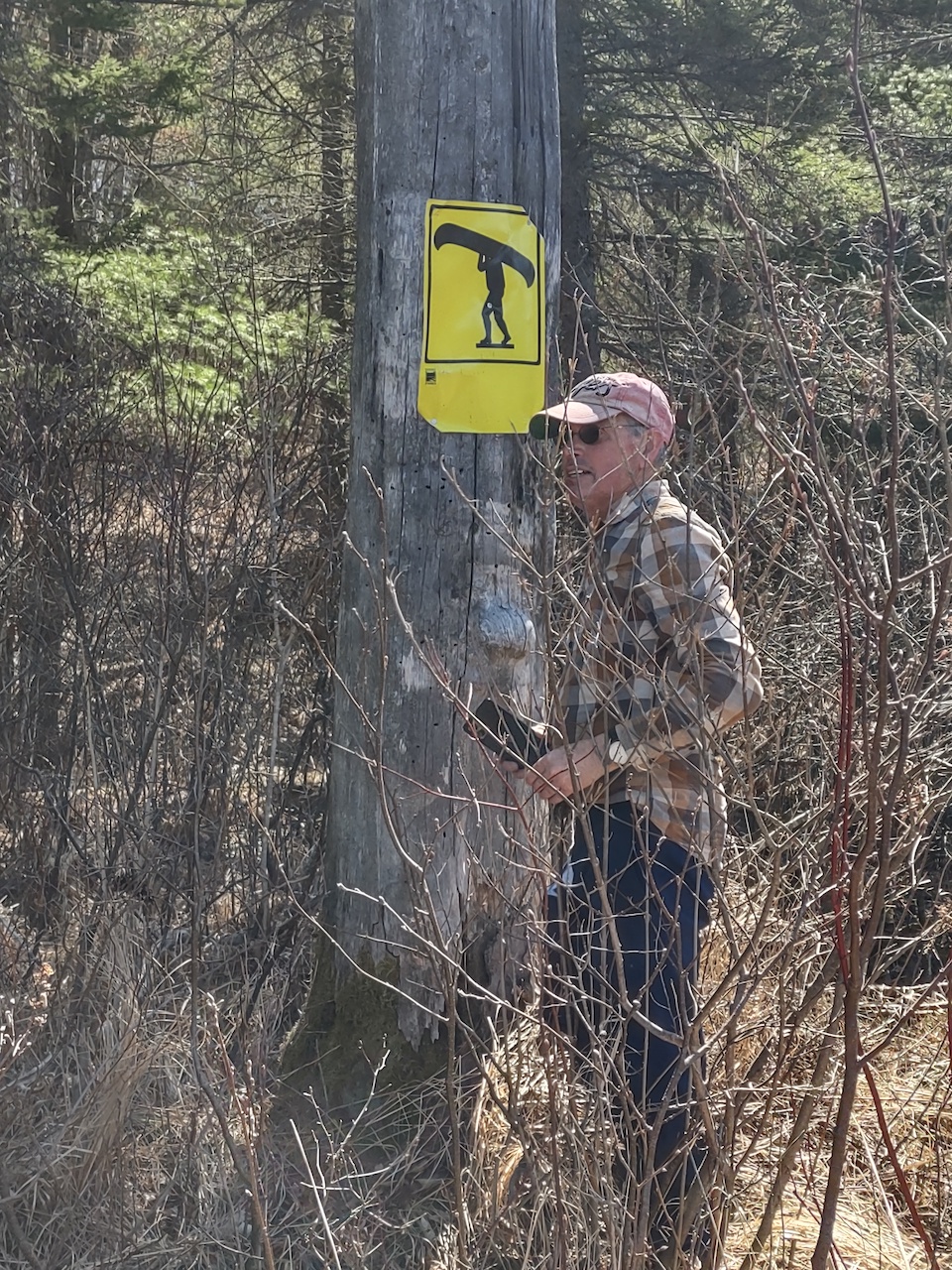
All of the portage signs along the route took a beating over the winter and were lying on the ground. We tacked them back up as best we could.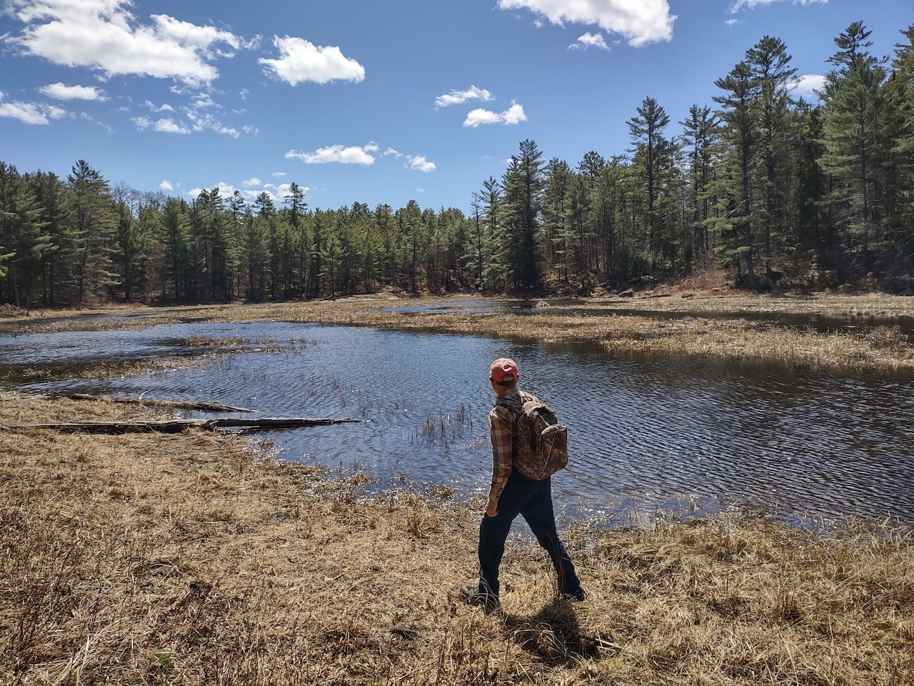
Starting back -- this image provides a better sense of the pond between the lakes.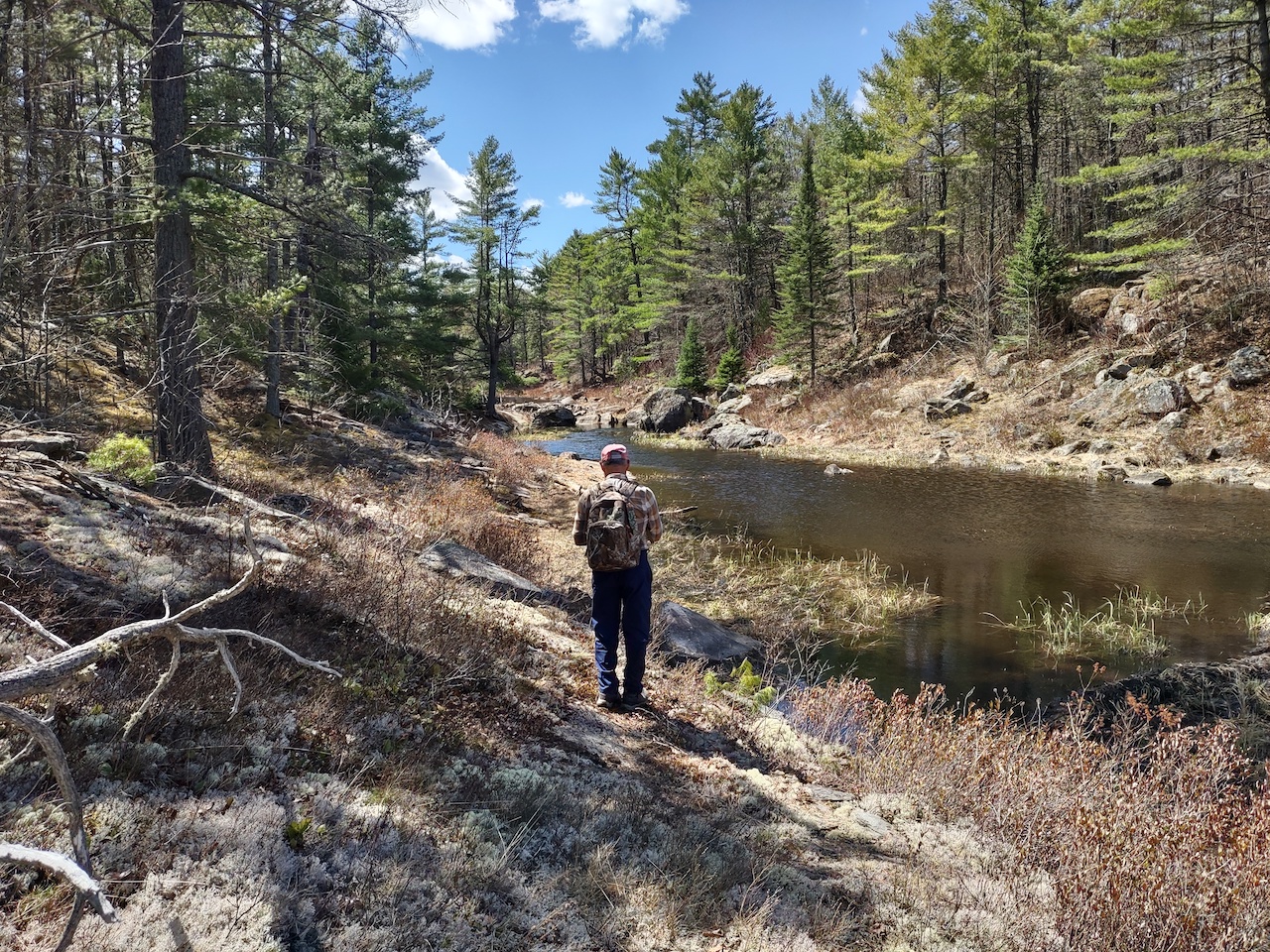
Making our way back to Grass-pink where we planned to stop for lunch and a change of socks. I should note that on our way back in the afternoon, after leaving Grass-pink, I lost my phone. Not sure how exactly, but it means we don't have the usual number of images available for creating a trip report since we usually both take photos during our hikes.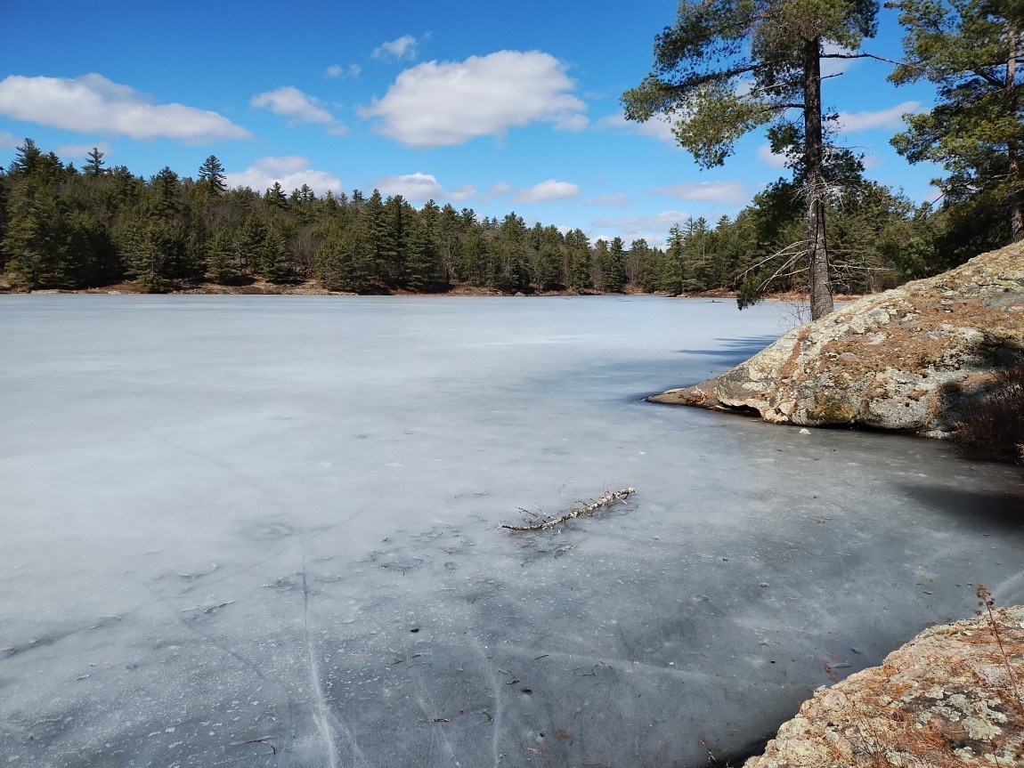
This picture was taken on March 28, 2024. On this current trip we stopped here again for lunch.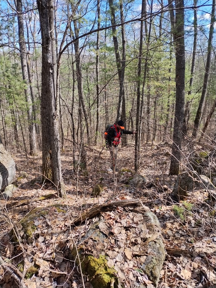
I've included this image, also from our 2024 hike, to illustrate how steep and challenging the terrain is between Grass-pink and Pine River. The climb is so steep in places that you literally have to grab on to the small trees to pull yourself up. In the past, even with a portage route, it is difficult to see how someone could carry a canoe over such a long climb.
The climb is rewarded when you reach the height of land and can see the drainage valleys on either side, with water flowing down the east side to Pine River and from there into the Bonnechere River and on to Round Lake. And to the west, the flow is down to Grass-pink, McDonald Creek and eventually Grand Lake.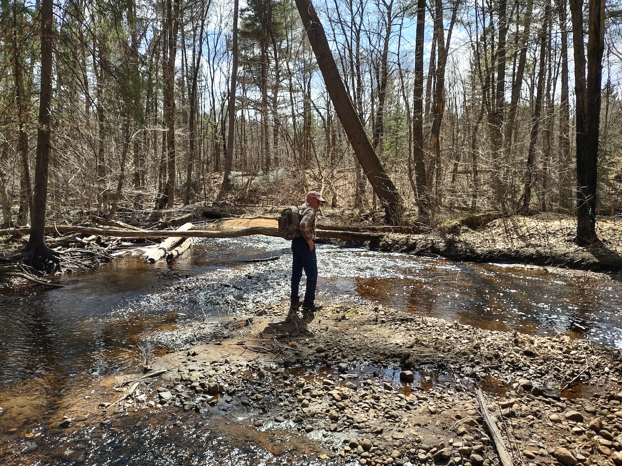
Mid-afternoon now -- we are back to Zigzag Creek.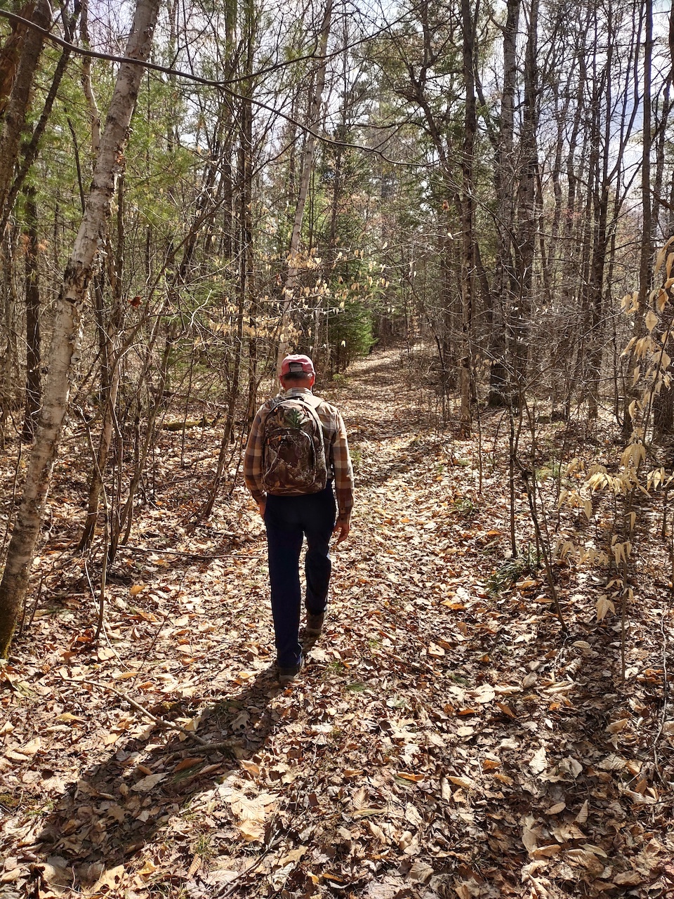
After so many hours of bushwhacking, it was good to get onto a trail for the final stretch of the hike. This was our first longer hike of the season so by this point the legs were feeling the effects of the distance and the climbing.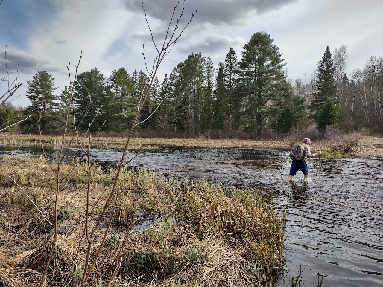
4:30 PM -- crossing the river and nearing the end of the hike. At this point there is just one thing on our minds -- what's for supper!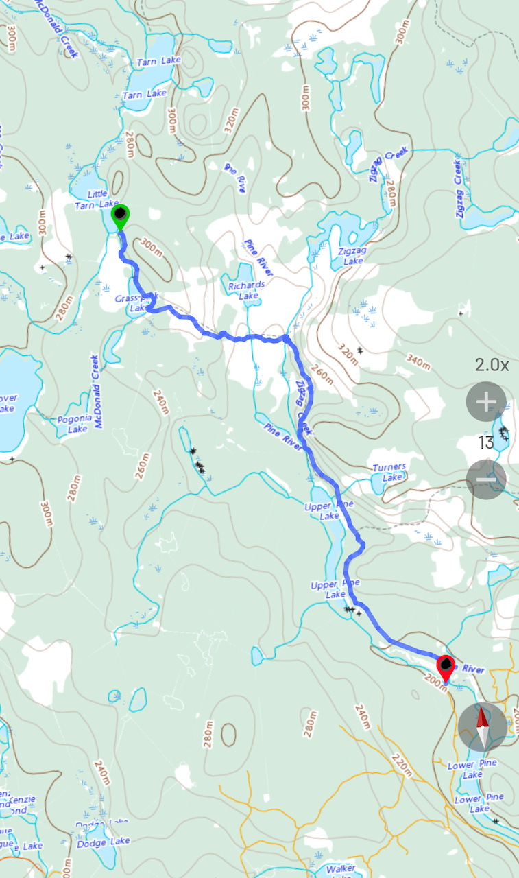
Our route -- Time: 10 hrs, 4 min. Distance: 20.96 km. Average Speed: 2.1 km/h
This area between Upper Pine Lake and Tarn Lake to the north is within one of the designated "nature reserves" in the park. On the route we took, after leaving Upper Pine, we saw no sign of human presence or activity -- no roads and no logging, One would hope there will always be such protected areas in the park.
This and our other trip reports can be found on our website.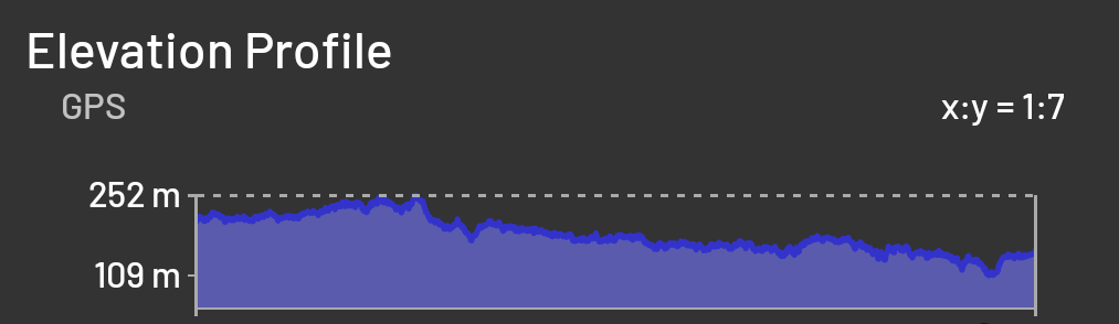
Last edited by Trail (5/06/2026 11:54 am)
![]() Offline
Offline
Great adventure. Thanks very much for posting.
![]() Offline
Offline
you guys sure do pack on the miles
![]() Offline
Offline
Another great one, thank you for posting! That jump over ZigZag looks harrowing - I watched the video thinking of how quickly things could go sideways ![]()
![]() Offline
Offline
Right.. that was certainly on our minds. We went up and down along the creek looking for a better crossing point. There is a large marsh and beaver pond above this point, and below a sharp drop off. So this turned out to be the best option. It was a relief to be across.⁷

 1 of 1